MyTopo
Blue Mountain Texas US Topo Map
Couldn't load pickup availability
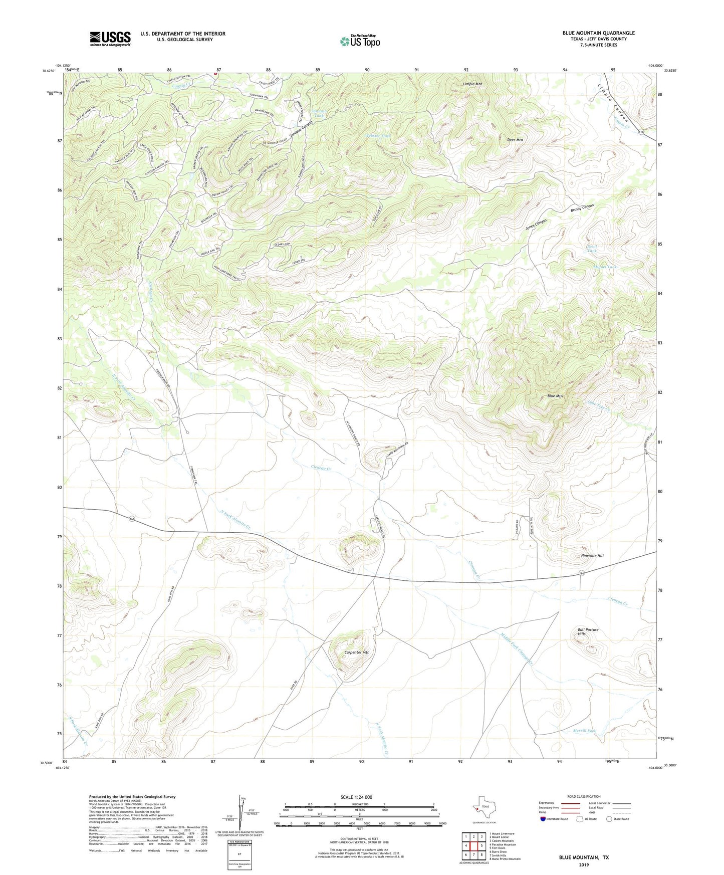
2023 topographic map quadrangle Blue Mountain in the state of Texas. Scale: 1:24000. Based on the newly updated USGS 7.5' US Topo map series, this map is in the following counties: Jeff Davis. The map contains contour data, water features, and other items you are used to seeing on USGS maps, but also has updated roads and other features. This is the next generation of topographic maps. Printed on high-quality waterproof paper with UV fade-resistant inks.
Quads adjacent to this one:
West: Paradise Mountain
Northwest: Mount Livermore
North: Mount Locke
Northeast: Casket Mountain
East: Fort Davis
Southeast: Mano Prieto Mountain
South: Smith Hills
Southwest: Burro Draw
This map covers the same area as the classic USGS quad with code o30104e1.
Contains the following named places: Blue Mountain, Blue Mountain School, Bull Pasture Hills, Carpenter Mountain, Davis Mountain Resort Cemetery, Deer Mountain, Devil Tank, Jones Canyon, Limpia Mountain, Lower Jones Windmill, Merrill Fork, Miguel Tank, Ninemile Hill, Point of Rocks Roadside Park, Santana Tank, Upper Jones Windmill, Webster Tank