MyTopo
Mount Nebo Texas US Topo Map
Couldn't load pickup availability
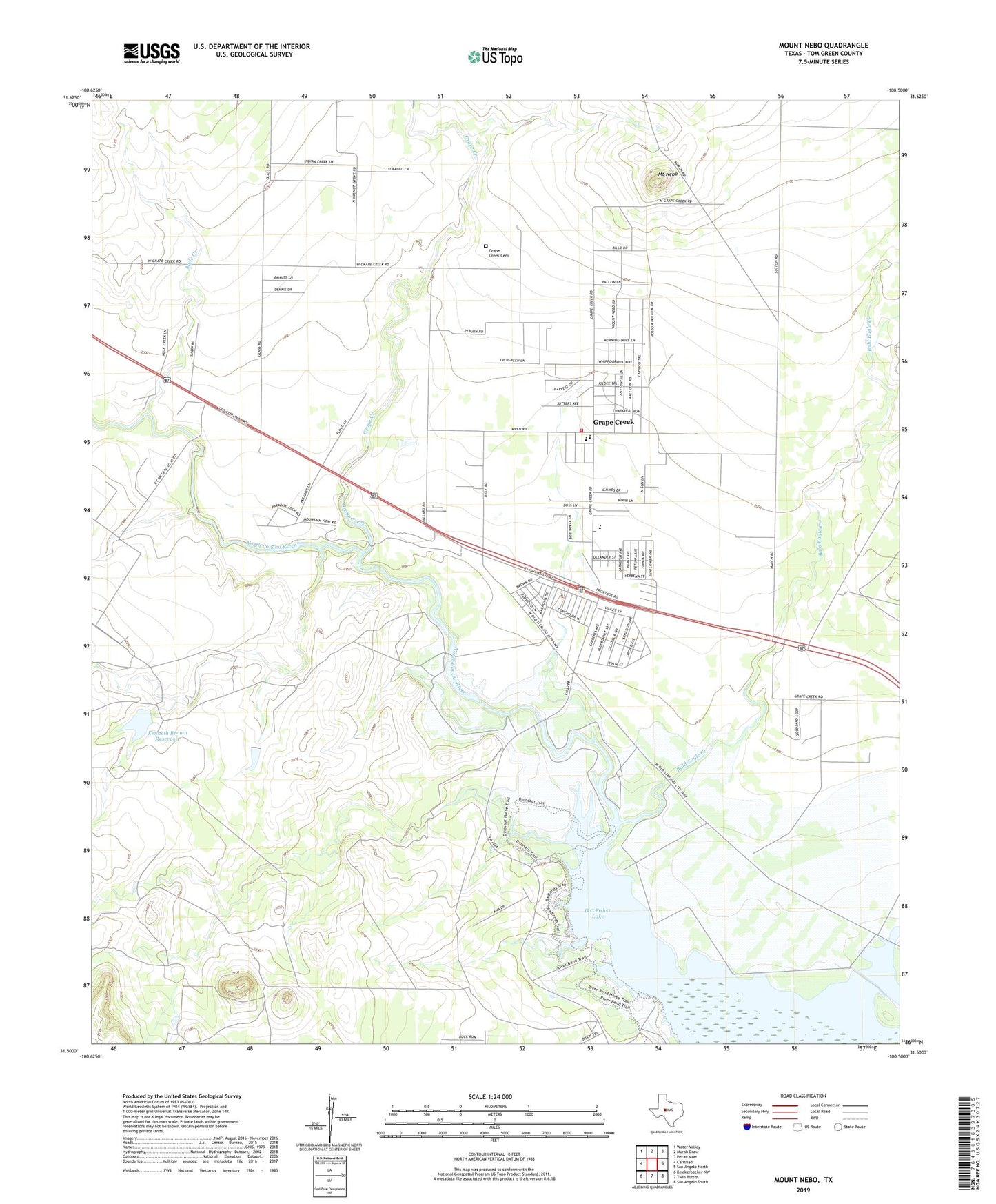
2022 topographic map quadrangle Mount Nebo in the state of Texas. Scale: 1:24000. Based on the newly updated USGS 7.5' US Topo map series, this map is in the following counties: Tom Green. The map contains contour data, water features, and other items you are used to seeing on USGS maps, but also has updated roads and other features. This is the next generation of topographic maps. Printed on high-quality waterproof paper with UV fade-resistant inks.
Quads adjacent to this one:
West: Carlsbad
Northwest: Water Valley
North: Murph Draw
Northeast: Pecan Mott
East: San Angelo North
Southeast: San Angelo South
South: Twin Buttes
Southwest: Knickerbocker NW
This map covers the same area as the classic USGS quad with code o31100e5.
Contains the following named places: Bald Eagle Creek, Brown Ranch, Fairview Accelerated School - Grape Creek, Grape Creek, Grape Creek Cemetery, Grape Creek Census Designated Place, Grape Creek Elementary School, Grape Creek High School, Grape Creek Middle School, Grape Creek Volunteer Fire Department, Grape Creek-Pulliam School, Kenneth Brown Reservoir, Kenneth Brown Reservoir Dam, KIDY-TV (San Angelo), KKLK-FM (San Angelo), Mount Nebo, Mule Creek, San Angelo State Park - North Shore, Trinity Early Childhood - Grape Creek, ZIP Code: 76901