MyTopo
Neely Arroyo Texas US Topo Map
Couldn't load pickup availability
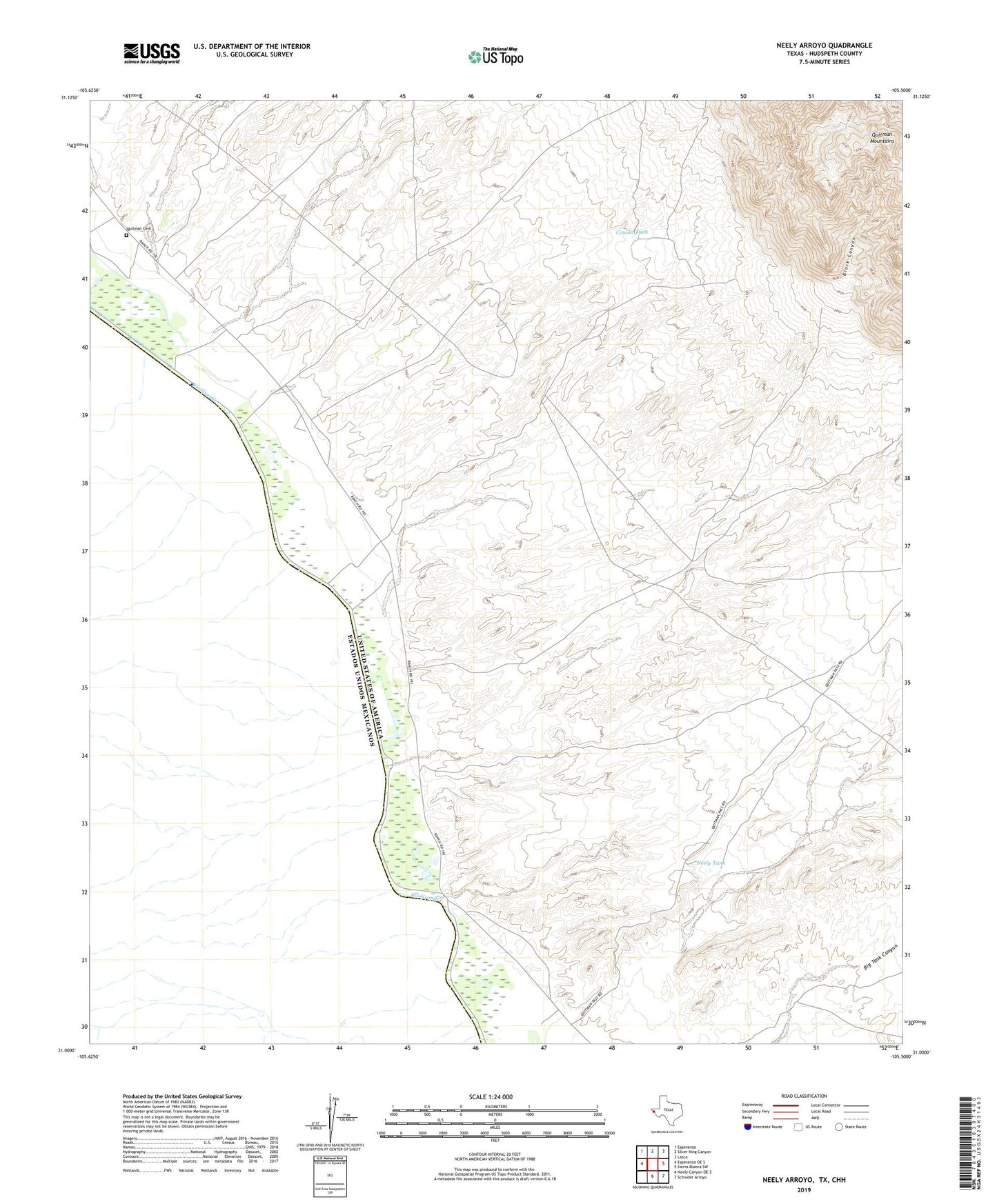
2022 topographic map quadrangle Neely Arroyo in the state of Texas. Scale: 1:24000. Based on the newly updated USGS 7.5' US Topo map series, this map is in the following counties: Hudspeth. The map contains contour data, water features, and other items you are used to seeing on USGS maps, but also has updated roads and other features. This is the next generation of topographic maps. Printed on high-quality waterproof paper with UV fade-resistant inks.
Quads adjacent to this one:
West: Esperanza OE S
Northwest: Esperanza
North: Silver King Canyon
Northeast: Lasca
East: Sierra Blanca SW
Southeast: Schroder Arroyo
South: Neely Canyon OE S
Contains the following named places: Black Canyon, Cowan Tank, Fort Quitman, McClintock Arroyo, Neely Arroyo, Neely Ranch, Neely Tank, Quitman Cemetery