MyTopo
Sierra Blanca SW Texas US Topo Map
Couldn't load pickup availability
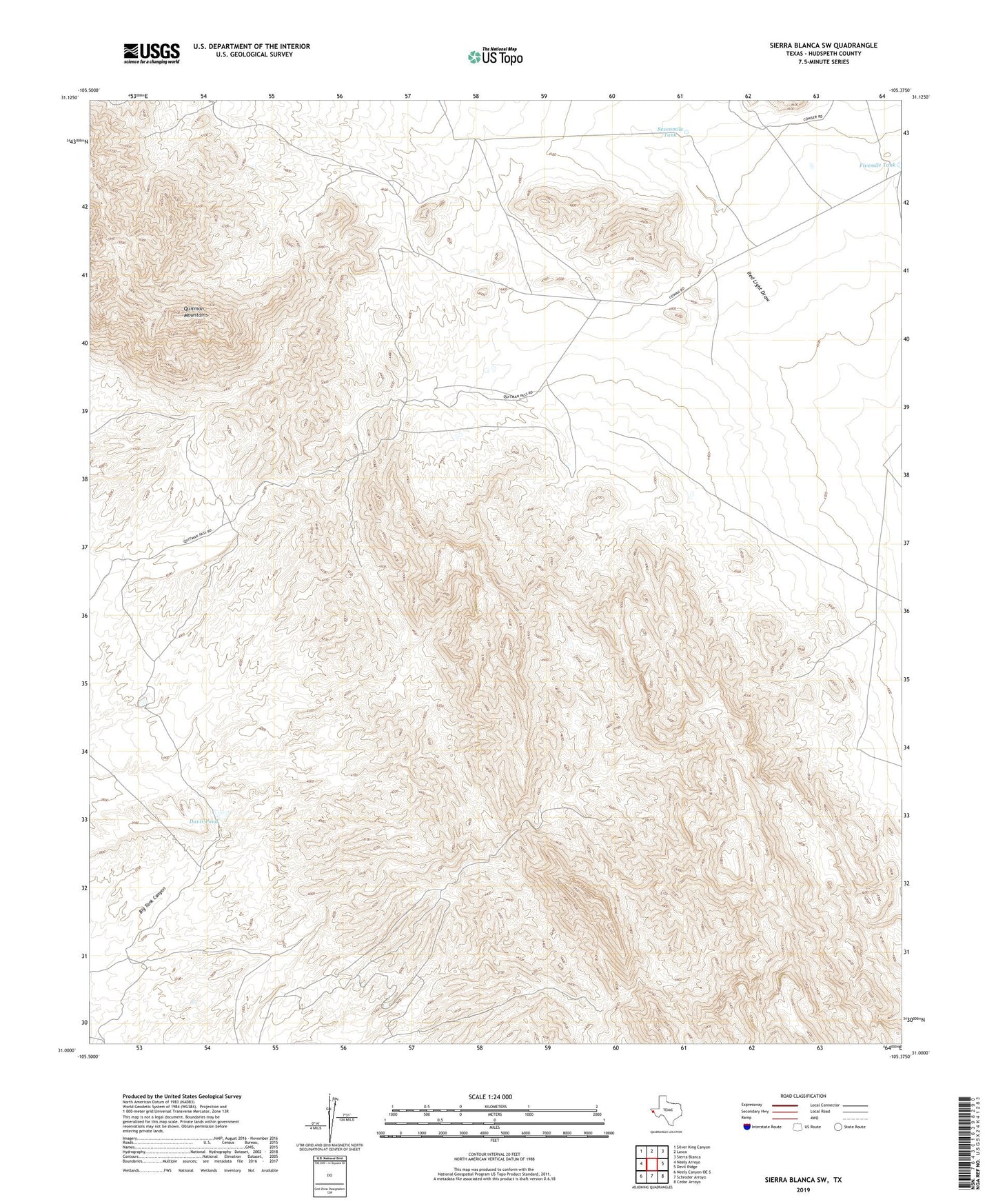
2022 topographic map quadrangle Sierra Blanca SW in the state of Texas. Scale: 1:24000. Based on the newly updated USGS 7.5' US Topo map series, this map is in the following counties: Hudspeth. The map contains contour data, water features, and other items you are used to seeing on USGS maps, but also has updated roads and other features. This is the next generation of topographic maps. Printed on high-quality waterproof paper with UV fade-resistant inks.
Quads adjacent to this one:
West: Neely Arroyo
Northwest: Silver King Canyon
North: Lasca
Northeast: Sierra Blanca
East: Devil Ridge
Southeast: Cedar Arroyo
South: Schroder Arroyo
Southwest: Neely Canyon OE S
This map covers the same area as the classic USGS quad with code o31105a4.
Contains the following named places: Davis Pond, Fivemile Tank, Henshaw Well, Sevenmile Tank, Tammin Ranch, West Windmill