MyTopo
Lasca Texas US Topo Map
Couldn't load pickup availability
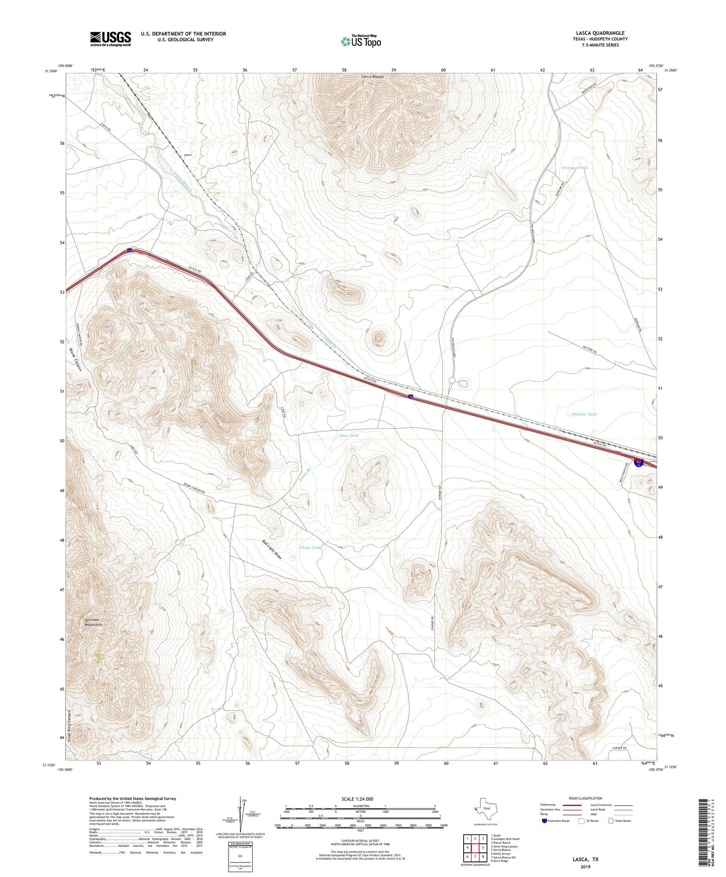
2022 topographic map quadrangle Lasca in the state of Texas. Scale: 1:24000. Based on the newly updated USGS 7.5' US Topo map series, this map is in the following counties: Hudspeth. The map contains contour data, water features, and other items you are used to seeing on USGS maps, but also has updated roads and other features. This is the next generation of topographic maps. Printed on high-quality waterproof paper with UV fade-resistant inks.
Quads adjacent to this one:
West: Silver King Canyon
Northwest: Small
North: Gunsight Hills South
Northeast: Pierce Ranch
East: Sierra Blanca
Southeast: Devil Ridge
South: Sierra Blanca SW
Southwest: Neely Arroyo
This map covers the same area as the classic USGS quad with code o31105b4.
Contains the following named places: Blanca Mountain Well, Choke Tank, Deer Tank, Etholen, Etholen Tank, Granger Tank, Lasca, Love Ranch, Quitman Mountains, United States Border Patrol Checkpoint