MyTopo
Nolanville Texas US Topo Map
Couldn't load pickup availability
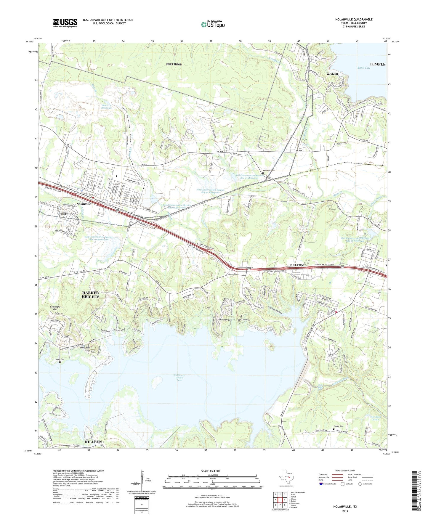
2022 topographic map quadrangle Nolanville in the state of Texas. Scale: 1:24000. Based on the newly updated USGS 7.5' US Topo map series, this map is in the following counties: Bell. The map contains contour data, water features, and other items you are used to seeing on USGS maps, but also has updated roads and other features. This is the next generation of topographic maps. Printed on high-quality waterproof paper with UV fade-resistant inks.
Quads adjacent to this one:
West: Killeen
Northwest: Post Oak Mountain
North: Bland
Northeast: Moffat
East: Belton
Southeast: Holland
South: Salado
Southwest: Youngsport
This map covers the same area as the classic USGS quad with code o31097a5.
Contains the following named places: Bluff Park, Burris Cemetery, Camp Arrowhead Boy Scout Camp, Camp Tahuaya, CEN-TEX Humane Society, Chalk Ridge Falls, Chalk Ridge Falls Park, Chalk Ridge Falls Park Trail, Christian Farms, Church of Christ, Church of Christ Campground, City of Nolanville, Comanche Gap, Dana Peak, Dana Peak Park, Dana Peak Park Trail, Dog Ridge, End of Time Church of God, First Baptist Church, Harvest Center Church, Highway of Holiness Church, J W Sims Community Center, Keys Valley Church, KLFX-FM (Harker Heights), KYZZ-FM (Belton), Lake Boyd Callan, McDowell Cemetery, Nolan Valley Church, Nolanville, Nolanville City Hall, Nolanville Elementary School, Nolanville Fire Department and Emergency Medical Service, Nolanville Police Department, Nolanville Post Office, Nolanville Student Achievement Center, North Nolan Creek, Overlook Park, Proctor Cemetery, Riversbend Park, Shaw Branch, Shaw Creek Dam, Shaw Creek Reservoir, Soil Conservation Service Site 10 Dam, Soil Conservation Service Site 10 Reservoir, Soil Conservation Service Site 11 Dam, Soil Conservation Service Site 11 Reservoir, Soil Conservation Service Site 12 Dam, Soil Conservation Service Site 12 Reservoir, Soil Conservation Service Site 13 Dam, Soil Conservation Service Site 13 Reservoir, Soil Conservation Service Site 14 Dam, Soil Conservation Service Site 14 Reservoir, Soil Conservation Service Site 15 Dam, Soil Conservation Service Site 15 Reservoir, South Nolan Creek, Stillhouse Baptist Church, Stillhouse Hollow, Stillhouse Hollow Dam, Stillhouse Hollow Lake, Stillhouse Park, Stillhouse Volunteer Fire Department, The Narrows, Union Grove, Union Grove Park, United Methodist Church, Westcliff, Westcliff Park, Yarrell Well Number Two, ZIP Code: 76559