MyTopo
O'Keefe Lake Texas US Topo Map
Couldn't load pickup availability
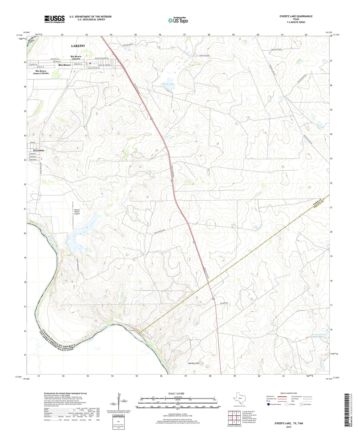
2022 topographic map quadrangle O'Keefe Lake in the state of Texas. Scale: 1:24000. Based on the newly updated USGS 7.5' US Topo map series, this map is in the following counties: Webb, Zapata. The map contains contour data, water features, and other items you are used to seeing on USGS maps, but also has updated roads and other features. This is the next generation of topographic maps. Printed on high-quality waterproof paper with UV fade-resistant inks.
Quads adjacent to this one:
West: Isla Mesteno
Northwest: Laredo West OE S
North: Laredo South
Northeast: Blancas Creek North
East: Blancas Creek South
Southeast: Arroyo Salado East
South: Arroyo Salado West
This map covers the same area as the classic USGS quad with code o27099c4.
Contains the following named places: A Ambulance Service, Becerra Creek, City of Rio Bravo, Dolores Colonia, El Cenizo, La Perla Ranch Lake Number 1, La Perla Ranch Lake Number 1 Dam, Mendez Hills, O'Keefe Dam, O'Keefe Lake, Rancho Blanco Airport, Rancho Blanco Lake, Rio Bravo, Rio Bravo Annex Colonia, Rio Bravo City Hall, Rio Bravo Colonia, Rio Bravo Fire Department, Zachary Dam, Zachry Lake Number 2, Zachry Lake Number 2 Dam, Zachry Lake Number 3, Zachry Lake Number 3 Dam