MyTopo
Oklaunion Texas US Topo Map
Couldn't load pickup availability
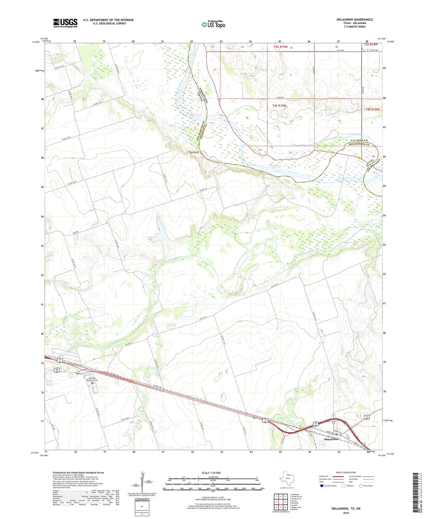
2022 topographic map quadrangle Oklaunion in the state of Texas. Scale: 1:24000. Based on the newly updated USGS 7.5' US Topo map series, this map is in the following counties: Wilbarger, Tillman. The map contains contour data, water features, and other items you are used to seeing on USGS maps, but also has updated roads and other features. This is the next generation of topographic maps. Printed on high-quality waterproof paper with UV fade-resistant inks.
Quads adjacent to this one:
West: Vernon
Northwest: Northside
North: Frederick SW
Northeast: Frederick SE
East: Davidson
Southeast: Harrold
South: Boggy Creek
Southwest: Lockett
This map covers the same area as the classic USGS quad with code o34099b2.
Contains the following named places: Butt - Holdsworth Memorial Library, Claud Ayres Dam, Claud Ayres Reservoir, Dugan Creek, Eastview Memorial Cemetery, Hinds, Oklaunion, Oklaunion Census Designated Place, Oklaunion Post Office, Paradise Creek, Plum Creek, Red Bluff, Salt Creek, Sharp Gin