MyTopo
Old Glory Texas US Topo Map
Couldn't load pickup availability
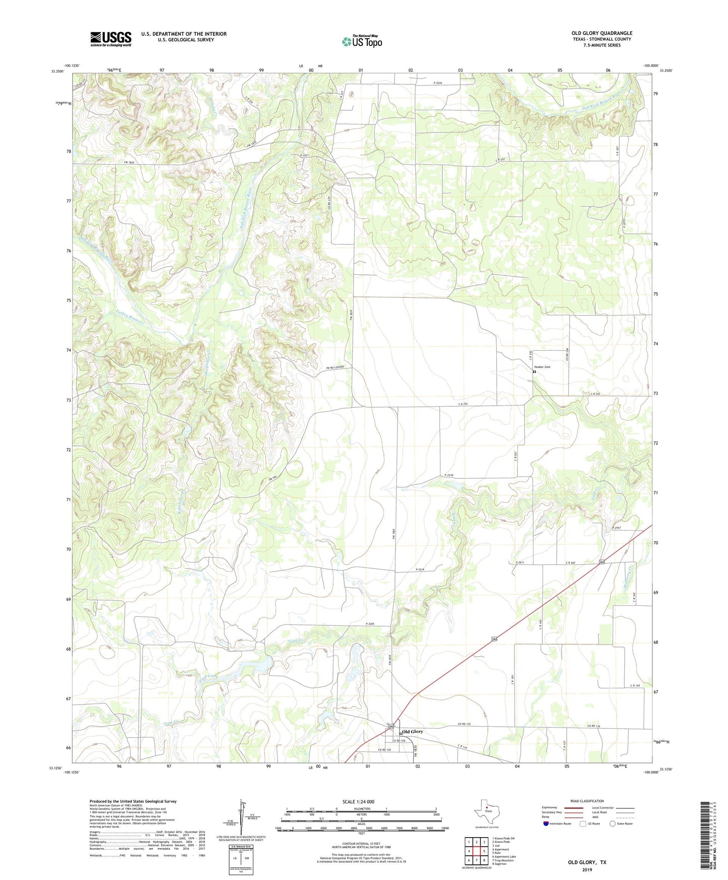
2022 topographic map quadrangle Old Glory in the state of Texas. Scale: 1:24000. Based on the newly updated USGS 7.5' US Topo map series, this map is in the following counties: Stonewall. The map contains contour data, water features, and other items you are used to seeing on USGS maps, but also has updated roads and other features. This is the next generation of topographic maps. Printed on high-quality waterproof paper with UV fade-resistant inks.
Quads adjacent to this one:
West: Aspermont
Northwest: Kiowa Peak SW
North: Kiowa Peak
Northeast: Jud
East: Rule
Southeast: Sagerton
South: Frog Mountain
Southwest: Aspermont Lake
This map covers the same area as the classic USGS quad with code o33100b1.
Contains the following named places: Hooker Cemetery, Jay Pumphrey Lake, Jay Pumphrey Lake Dam, Old Glory, Old Glory Oil Field, Old Glory Post Office, Pumphrey Oil Field, Rockhouse Creek, Sandlin, Turkey Roost Creek, Wilfong Creek, ZIP Code: 79540