
MyTopo
Orchard Texas US Topo Map
Couldn't load pickup availability
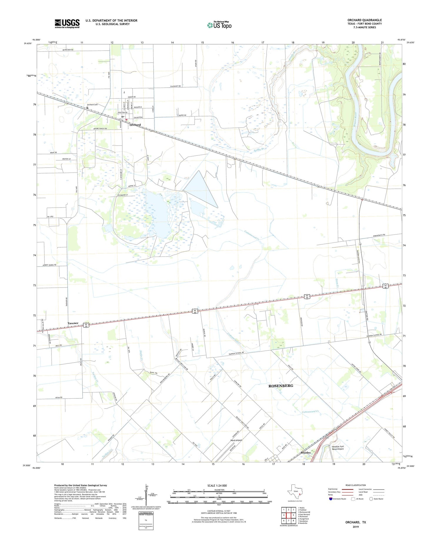
2019 topographic map quadrangle Orchard in the state of Texas. Scale: 1:24000. Based on the newly updated USGS 7.5' US Topo map series, this map is in the following counties: Fort Bend. The map contains contour data, water features, and other items you are used to seeing on USGS maps, but also has updated roads and other features. This is the next generation of topographic maps. Printed on high-quality waterproof paper with UV fade-resistant inks.
Quads adjacent to this one:
West: East Bernard
Northwest: Wallis
North: Fulshear
Northeast: Richmond NE
East: Richmond
Southeast: Needville
South: Kendleton
Southwest: Hungerford
Contains the following named places: Artesian Park, City of Orchard, Orchard, Orchard Cemetery, Orchard Community Building, Orchard Dome Oil and Gas Field, Orchard Post Office, Orchard Substation, Orchard Volunteer Fire Department, Orchard-Kendleton Division, San Gabriel Cemetery Annex, Sandy Branch, Tavener, Ward Airpark, ZIP Code: 77464


