MyTopo
Riesel Texas US Topo Map
Couldn't load pickup availability
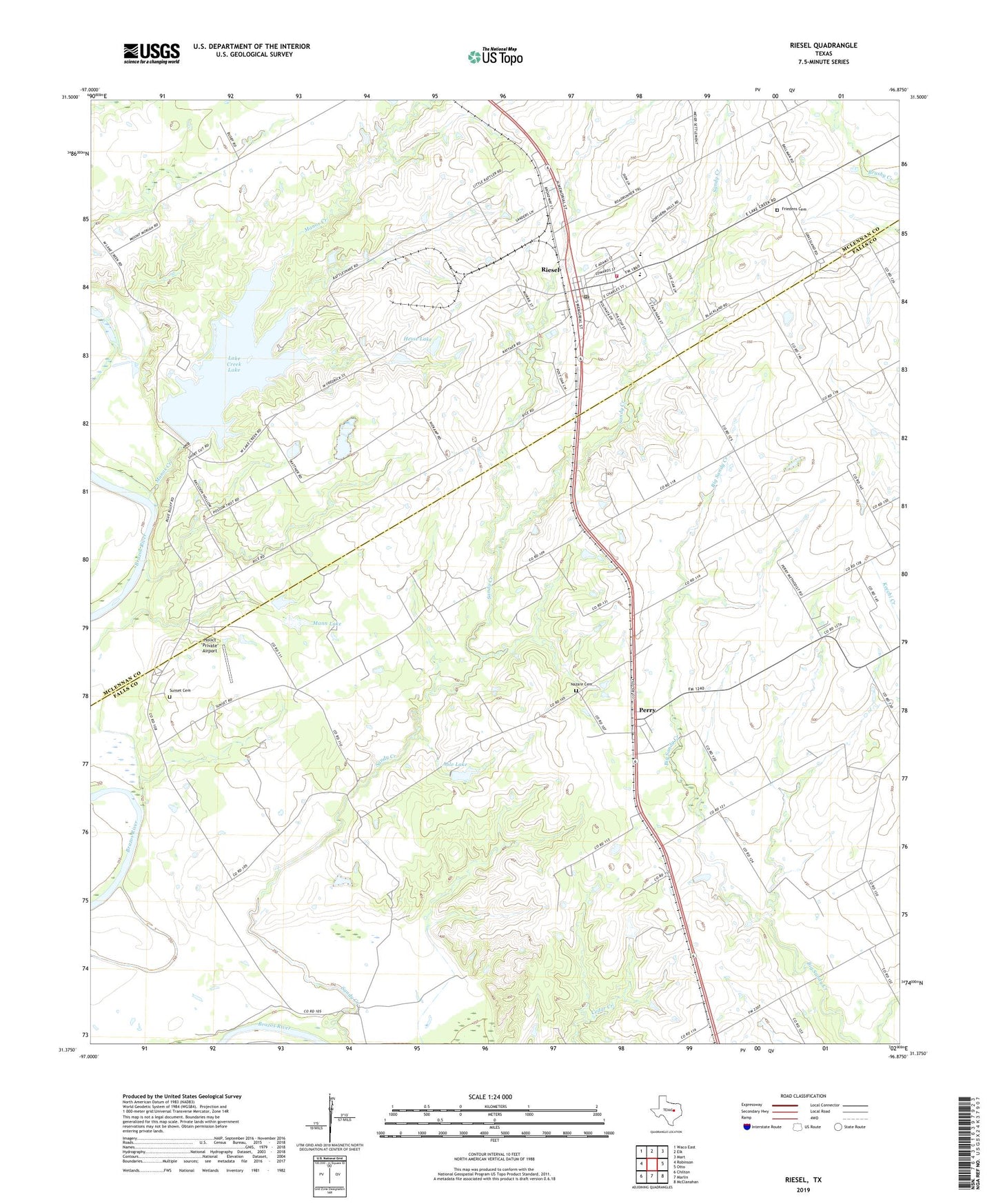
2022 topographic map quadrangle Riesel in the state of Texas. Scale: 1:24000. Based on the newly updated USGS 7.5' US Topo map series, this map is in the following counties: Falls, McLennan. The map contains contour data, water features, and other items you are used to seeing on USGS maps, but also has updated roads and other features. This is the next generation of topographic maps. Printed on high-quality waterproof paper with UV fade-resistant inks.
Quads adjacent to this one:
West: Robinson
Northwest: Waco East
North: Elk
Northeast: Mart
East: Otto
Southeast: McClanahan
South: Marlin
Southwest: Chilton
This map covers the same area as the classic USGS quad with code o31096d8.
Contains the following named places: Able Lake, Able Lake Dam, Blackland, City of Riesel, Friedens Cemetery, Hebron School, Hesse Lake, Hesse Lake Dam, Holict "Private" Airport, Lake Creek Dam, Lake Creek Lake, Mann Lake, Mann Lake Dam, Manos Creek, Meier Settlement United Methodist Church, Nazare Cemetery, Nazare Church, New Zion Church, Perry, Perry Church, Riesel, Riesel City Hall, Riesel Post Office, Riesel School, Riesel Volunteer Fire Department, Saint Pauls Church, Springhill Church, Sunset Cemetery, Sunset Church, Sunset School, Texas No Name Number 11 Dam, Trinity Church, ZIP Code: 76682