MyTopo
Oyster Bayou Texas US Topo Map
Couldn't load pickup availability
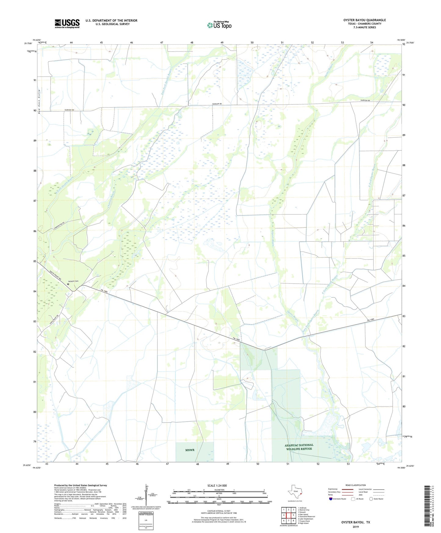
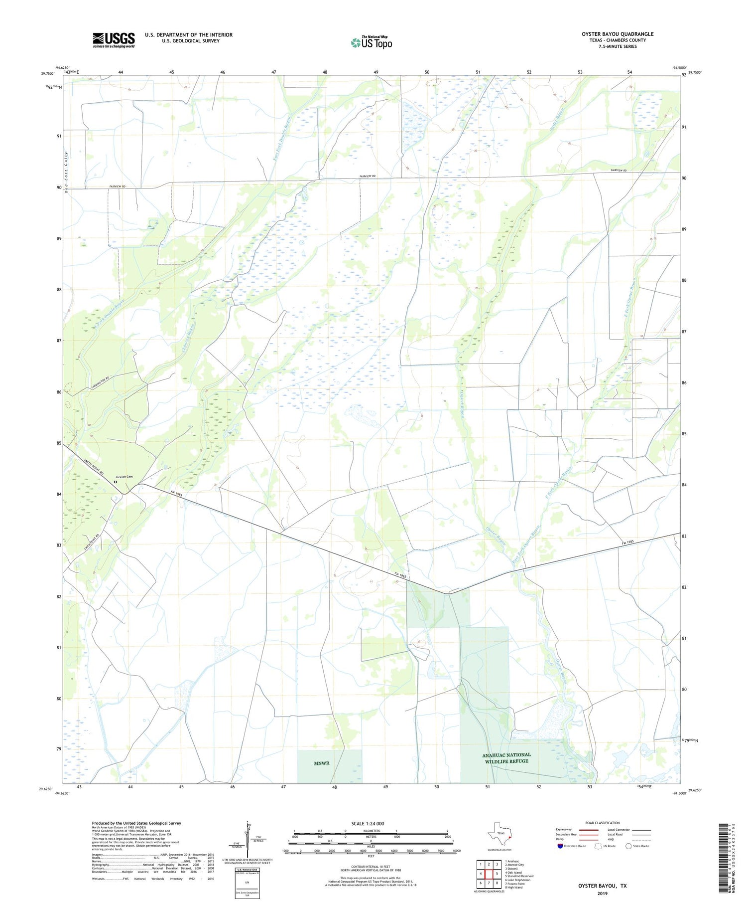
2019 topographic map quadrangle Oyster Bayou in the state of Texas. Scale: 1:24000. Based on the newly updated USGS 7.5' US Topo map series, this map is in the following counties: Chambers. The map contains contour data, water features, and other items you are used to seeing on USGS maps, but also has updated roads and other features. This is the next generation of topographic maps. Printed on high-quality waterproof paper with UV fade-resistant inks.
Quads adjacent to this one:
West: Oak Island
Northwest: Anahuac
North: Monroe City
Northeast: Stowell
East: Stanolind Reservoir
Southeast: High Island
South: Frozen Point
Southwest: Lake Stephenson
Contains the following named places: Bad East Gully, Chambers County Constable's Office Precinct 3, Chimney Bayou, East Fork Oyster Bayou, Jackson Cemetery, Oyster Bayou Oil Field, Pine Island School, ZIP Code: 77514