MyTopo
Lake Stephenson Texas US Topo Map
Couldn't load pickup availability
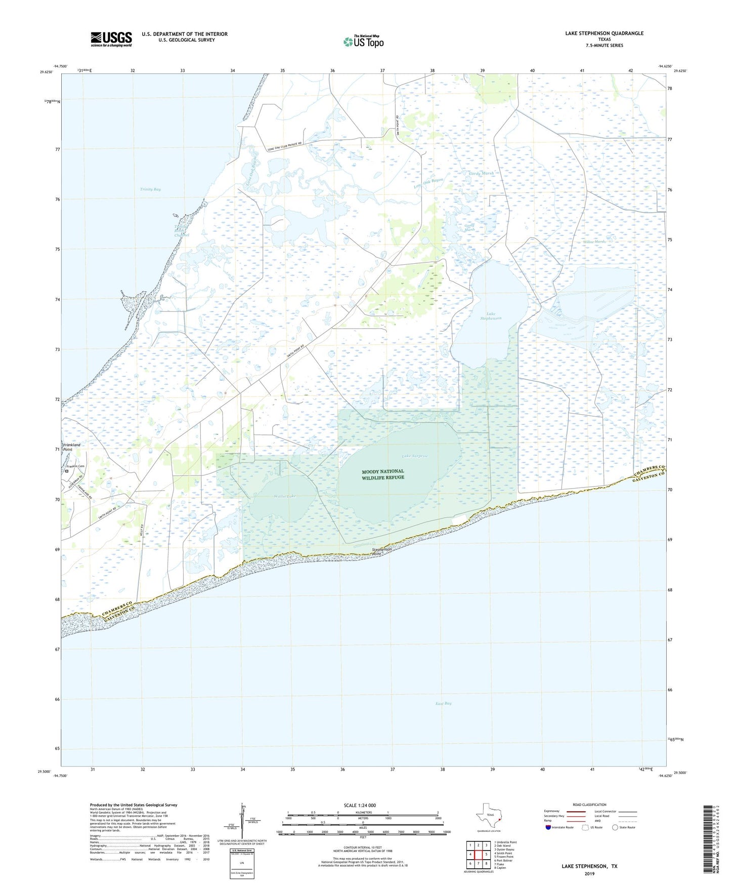
2022 topographic map quadrangle Lake Stephenson in the state of Texas. Scale: 1:24000. Based on the newly updated USGS 7.5' US Topo map series, this map is in the following counties: Chambers, Galveston. The map contains contour data, water features, and other items you are used to seeing on USGS maps, but also has updated roads and other features. This is the next generation of topographic maps. Printed on high-quality waterproof paper with UV fade-resistant inks.
Quads adjacent to this one:
West: Smith Point
Northwest: Umbrella Point
North: Oak Island
Northeast: Oyster Bayou
East: Frozen Point
Southeast: Caplen
South: Flake
Southwest: Port Bolivar
This map covers the same area as the classic USGS quad with code o29094e6.
Contains the following named places: E W Monteith Number 1 Levee, E W Monteith Number 1 Reservoir, E W Monteith Number 2 Levee, E W Monteith Number 2 Reservoir, E W Monteith Number 3 Levee, E W Monteith Number 3 Reservoir, East Bay, Frankland Cemetery, Gordy Marsh, Lake Stephenson, Lake Stephenson Oil Field, Lake Surprise, Lone Oak Bayou, Mays Oil Field, Moody National Wildlife Refuge, Stephenson Point, Wallis Lake, White Lake Oil Field