MyTopo
Payton Texas US Topo Map
Couldn't load pickup availability
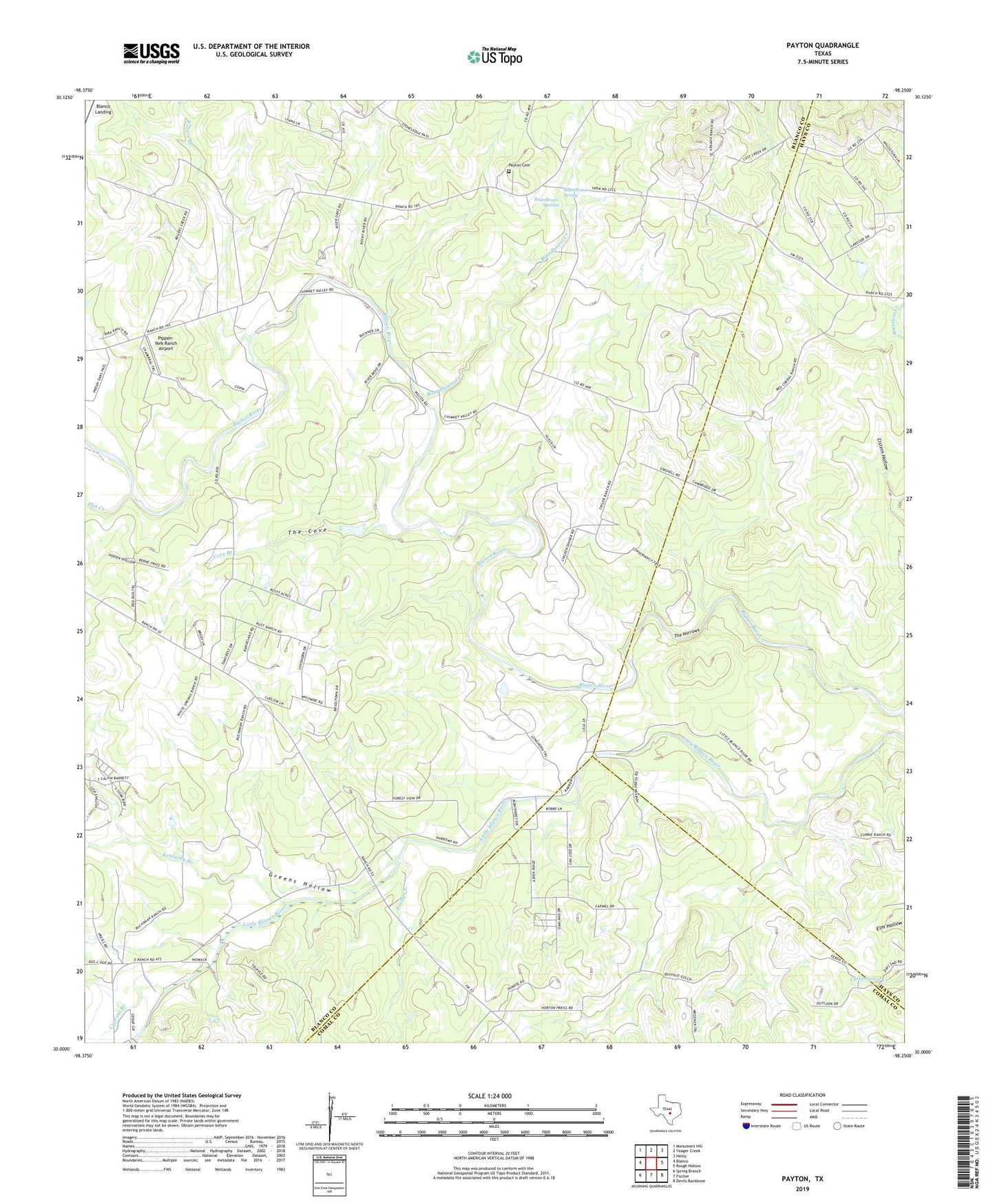
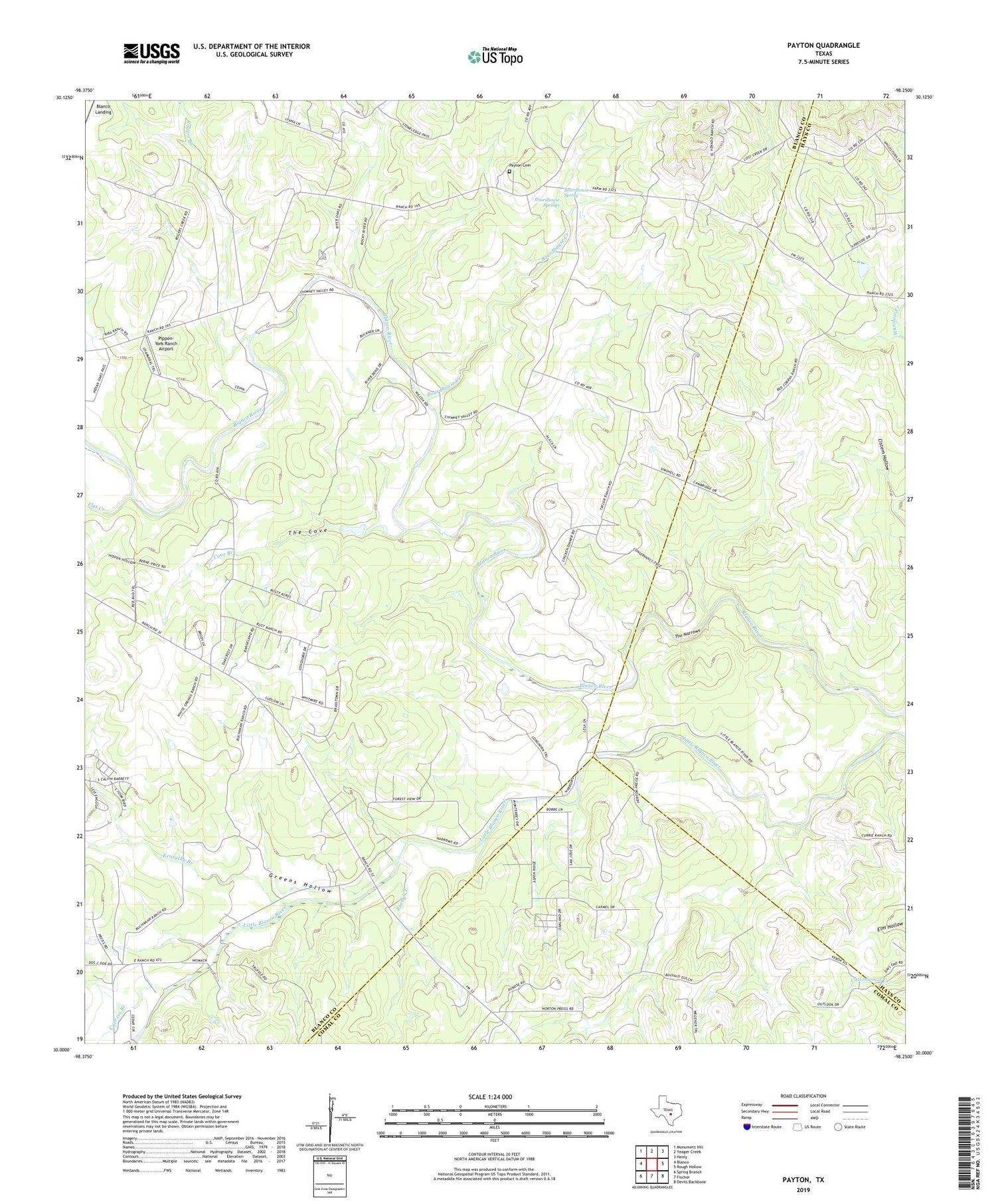
2019 topographic map quadrangle Payton in the state of Texas. Scale: 1:24000. Based on the newly updated USGS 7.5' US Topo map series, this map is in the following counties: Blanco, Hays, Comal. The map contains contour data, water features, and other items you are used to seeing on USGS maps, but also has updated roads and other features. This is the next generation of topographic maps. Printed on high-quality waterproof paper with UV fade-resistant inks.
Quads adjacent to this one:
West: Blanco
Northwest: Monument Hill
North: Yeager Creek
Northeast: Henly
East: Rough Hollow
Southeast: Devils Backbone
South: Fischer
Southwest: Spring Branch
Contains the following named places: Boardhouse Creek, Boardhouse Spring, Boardhouse Springs, Cistern Hollow, Cove Branch, Cypress Branch, Flat Creek, Greens Hollow, Kentucky Branch, Little Blanco River, Mount Horebe Church, Payton, Payton School, Peyton Cemetery, Pippen-York Ranch Airport, Rocky Creek, Rogers Branch, The Cove, The Narrows