MyTopo
Yeager Creek Texas US Topo Map
Couldn't load pickup availability
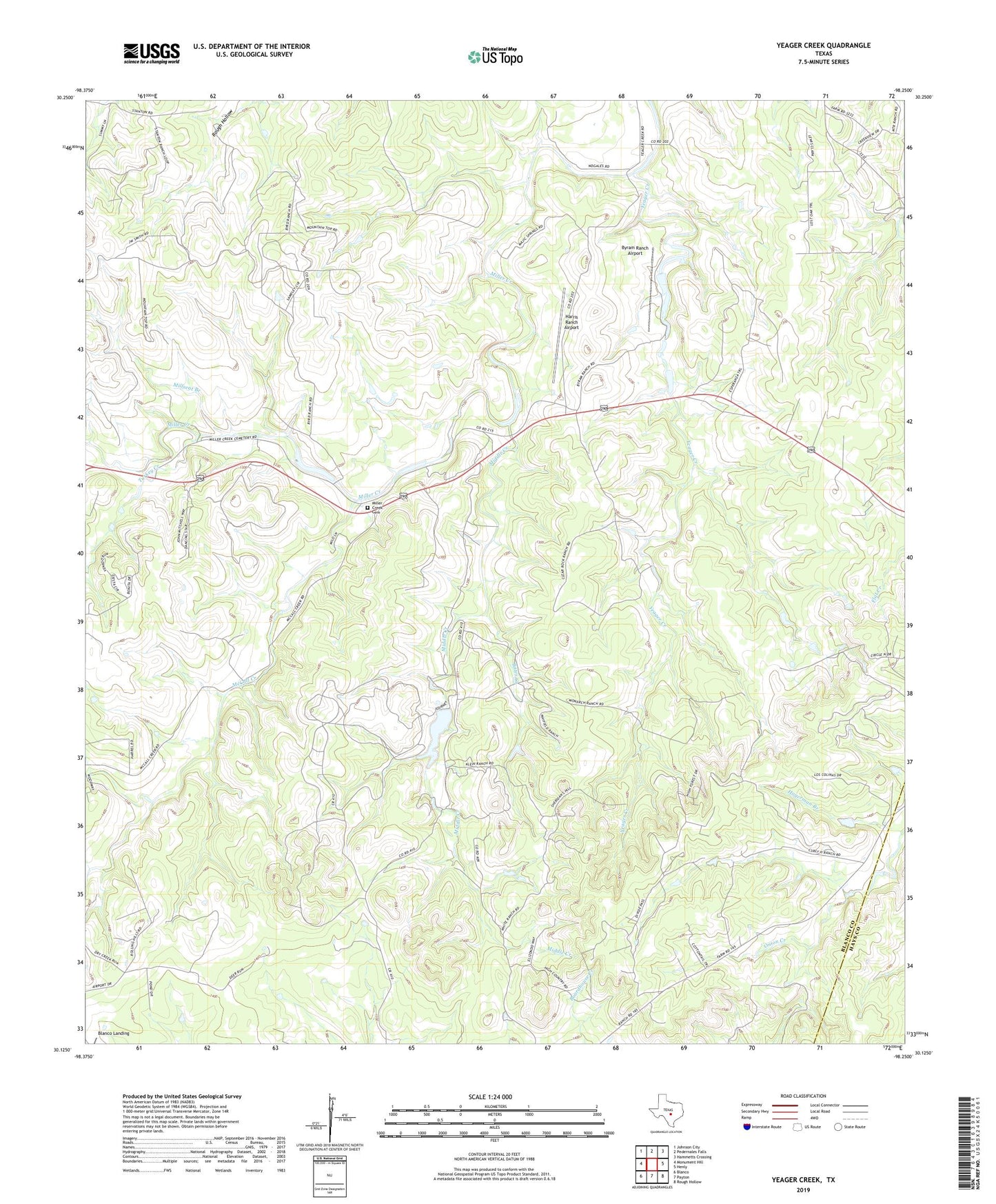
2022 topographic map quadrangle Yeager Creek in the state of Texas. Scale: 1:24000. Based on the newly updated USGS 7.5' US Topo map series, this map is in the following counties: Blanco, Hays. The map contains contour data, water features, and other items you are used to seeing on USGS maps, but also has updated roads and other features. This is the next generation of topographic maps. Printed on high-quality waterproof paper with UV fade-resistant inks.
Quads adjacent to this one:
West: Monument Hill
Northwest: Johnson City
North: Pedernales Falls
Northeast: Hammetts Crossing
East: Henly
Southeast: Rough Hollow
South: Payton
Southwest: Blanco
This map covers the same area as the classic USGS quad with code o30098b3.
Contains the following named places: Bates Creek, Blanco Landing, Byram Ranch Airport, Hagerman Branch, Harris Ranch Airport, McCall Creek, Middle Creek, Miller Creek Cemetery, Millseat Branch, Turkey Creek, Yeager Creek