MyTopo
Petteway Texas US Topo Map
Couldn't load pickup availability
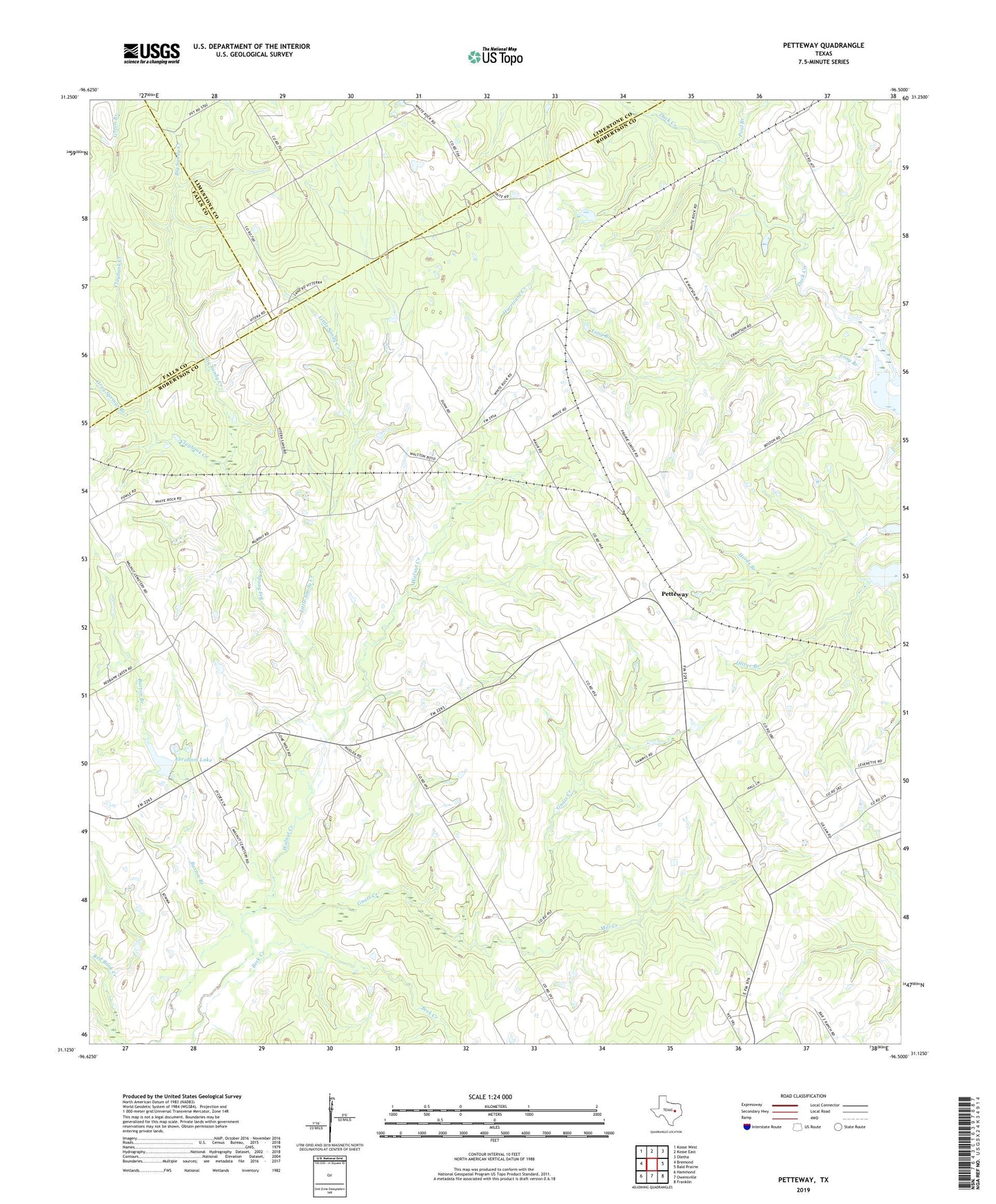
2019 topographic map quadrangle Petteway in the state of Texas. Scale: 1:24000. Based on the newly updated USGS 7.5' US Topo map series, this map is in the following counties: Robertson, Limestone, Falls. The map contains contour data, water features, and other items you are used to seeing on USGS maps, but also has updated roads and other features. This is the next generation of topographic maps. Printed on high-quality waterproof paper with UV fade-resistant inks.
Quads adjacent to this one:
West: Bremond
Northwest: Kosse West
North: Kosse East
Northeast: Oletha
East: Bald Prairie
Southeast: Franklin
South: Owensville
Southwest: Hammond
Contains the following named places: Abraham Lake, Abraham Lake Dam, Beck Creek, Big Sandy Creek, Claybank Creek, Gnats Creek, Gray Springs Branch, Hurricane Creek, Little Sandy Creek, Long Branch, Mill Creek, Petteway, Petteway Church, Pool Branch, Post Oak School, Walnut Cemetery, Walnut Church, White Rock