MyTopo
Piedra Parada Ranch Texas US Topo Map
Couldn't load pickup availability
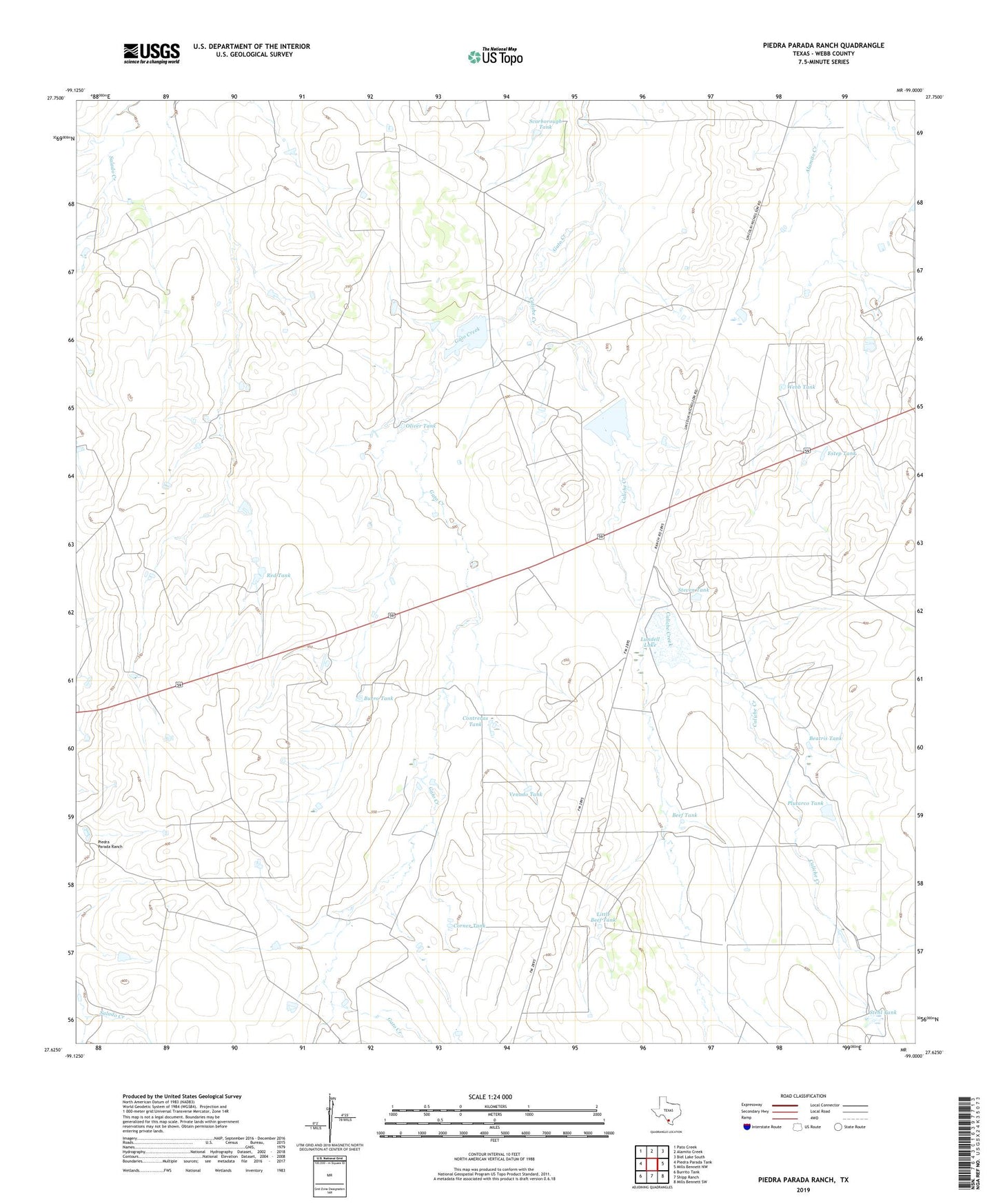
2022 topographic map quadrangle Piedra Parada Ranch in the state of Texas. Scale: 1:24000. Based on the newly updated USGS 7.5' US Topo map series, this map is in the following counties: Webb. The map contains contour data, water features, and other items you are used to seeing on USGS maps, but also has updated roads and other features. This is the next generation of topographic maps. Printed on high-quality waterproof paper with UV fade-resistant inks.
Quads adjacent to this one:
West: Piedra Parada Tank
Northwest: Pato Creek
North: Alamito Creek
Northeast: Biel Lake South
East: Mills Bennett NW
Southeast: Mills Bennett SW
South: Shipp Ranch
Southwest: Burrito Tank
This map covers the same area as the classic USGS quad with code o27099f1.
Contains the following named places: Beatris Tank, Beef Tank, Burro Tank, Caliche Creek, Contreras Tank, Corner Tank, Estep Tank, Hilltop Ranch, Home Tank, Little Beef Tank, Lundell Lake, Lundell Lake Dam, Oliver Tank, Piedra Parada Ranch, Plutarco Tank, Red Tank, Scarborough Tank, Stehl Tank, Steven Tank, Venado Tank, Webb Tank