MyTopo
La Paloma Ranch Texas US Topo Map
Couldn't load pickup availability
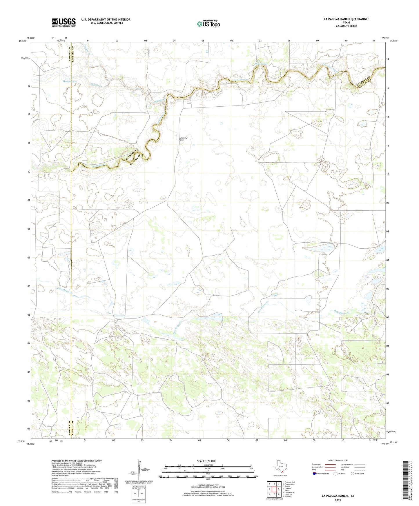
2022 topographic map quadrangle La Paloma Ranch in the state of Texas. Scale: 1:24000. Based on the newly updated USGS 7.5' US Topo map series, this map is in the following counties: Kenedy, Kleberg, Brooks. The map contains contour data, water features, and other items you are used to seeing on USGS maps, but also has updated roads and other features. This is the next generation of topographic maps. Printed on high-quality waterproof paper with UV fade-resistant inks.
Quads adjacent to this one:
West: Flowella
Northwest: Premont East
North: Paisano Lake
Northeast: Riviera
East: Sarita
Southeast: Turcotte
South: Sarita SW
Southwest: Falfurrias SE
This map covers the same area as the classic USGS quad with code o27097b8.
Contains the following named places: Arpones Windmill, Candado Windmill, Capitan Windmill, Carambana Windmill, Creek Windmill, Dormido Windmill, Ebanito Windmill, Encino Mucho Windmill, Four Corners Windmill, La Paloma Ranch, Marrano Windmill, McGill Dam, McGill Lake, Mike Windmill, Monte Negro Windmill, Monterrey Windmill, Moreno Lake, Muchos Hombres Windmill, Paisano Creek, Palobla Creek, Vibora Windmill, Zorillo Windmill, ZIP Code: 78385