MyTopo
Ricardo Texas US Topo Map
Couldn't load pickup availability
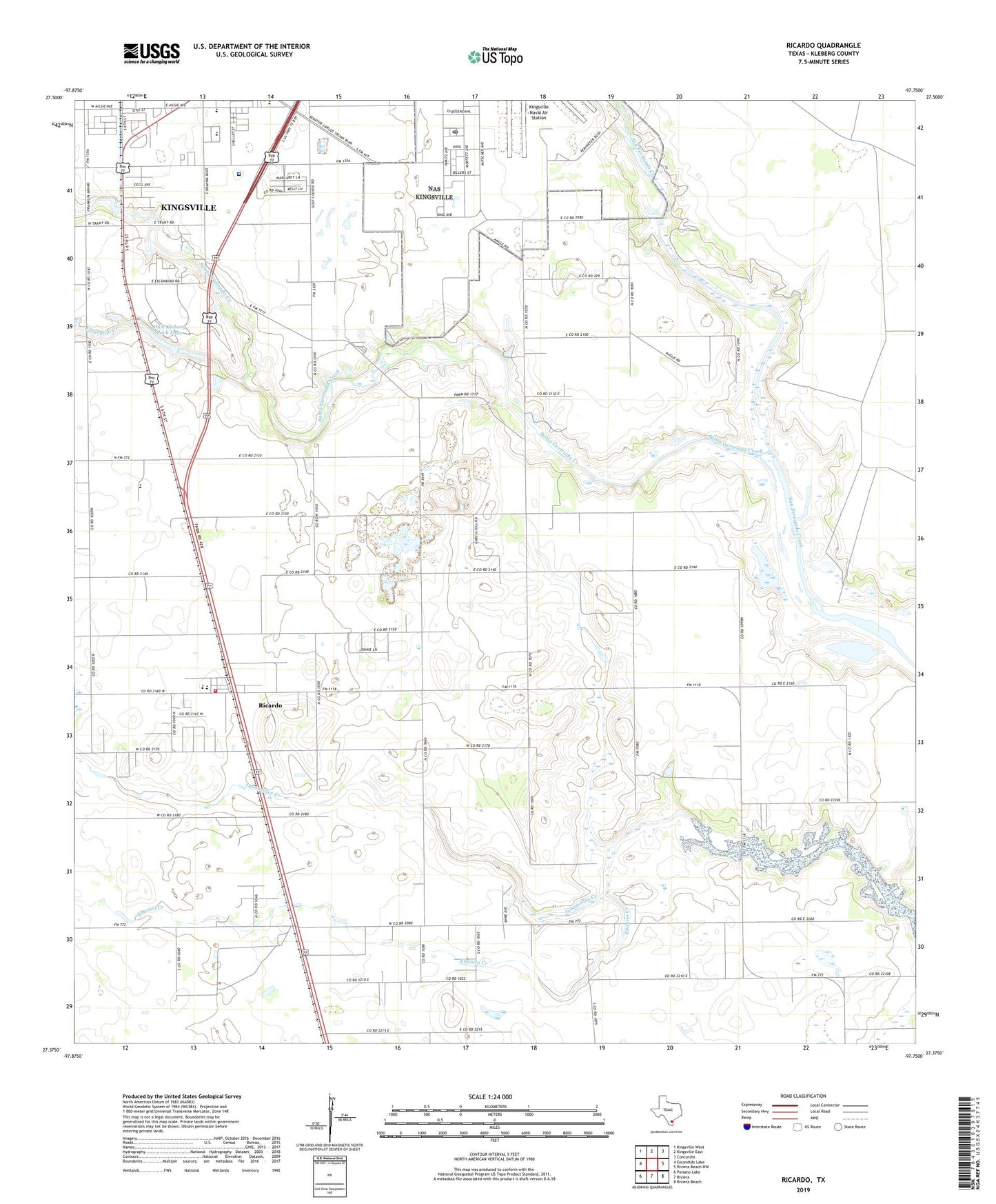
2022 topographic map quadrangle Ricardo in the state of Texas. Scale: 1:24000. Based on the newly updated USGS 7.5' US Topo map series, this map is in the following counties: Kleberg. The map contains contour data, water features, and other items you are used to seeing on USGS maps, but also has updated roads and other features. This is the next generation of topographic maps. Printed on high-quality waterproof paper with UV fade-resistant inks.
Quads adjacent to this one:
West: Escondido Lake
Northwest: Kingsville West
North: Kingsville East
Northeast: Concordia
East: Riviera Beach NW
Southeast: Riviera Beach
South: Riviera
Southwest: Paisano Lake
This map covers the same area as the classic USGS quad with code o27097d7.
Contains the following named places: Bordo Nuevo Windmill, Christus Spohn Hospital - Kleberg, Dick Kleberg Park, Dick Kleberg Park Dam, Dick Kleberg Park Lake, Ebanito Creek, Escondido Creek, King High School, Kingsville Post Office, Kleberg County Park, Kleberg Fire Department, Kleberg Park, Leoncitos Well, Northway Exposition Center, Pan American School, Perez Elementary School, Perez School, Ricardo, Ricardo Census Designated Place, Ricardo Elementary School, Ricardo Middle School, San Fernando Cemetery, Santa Gertrudis Creek, Sensible EMS, Vinatero Well, ZIP Code: 78363