
MyTopo
Richmond NE Texas US Topo Map
Couldn't load pickup availability
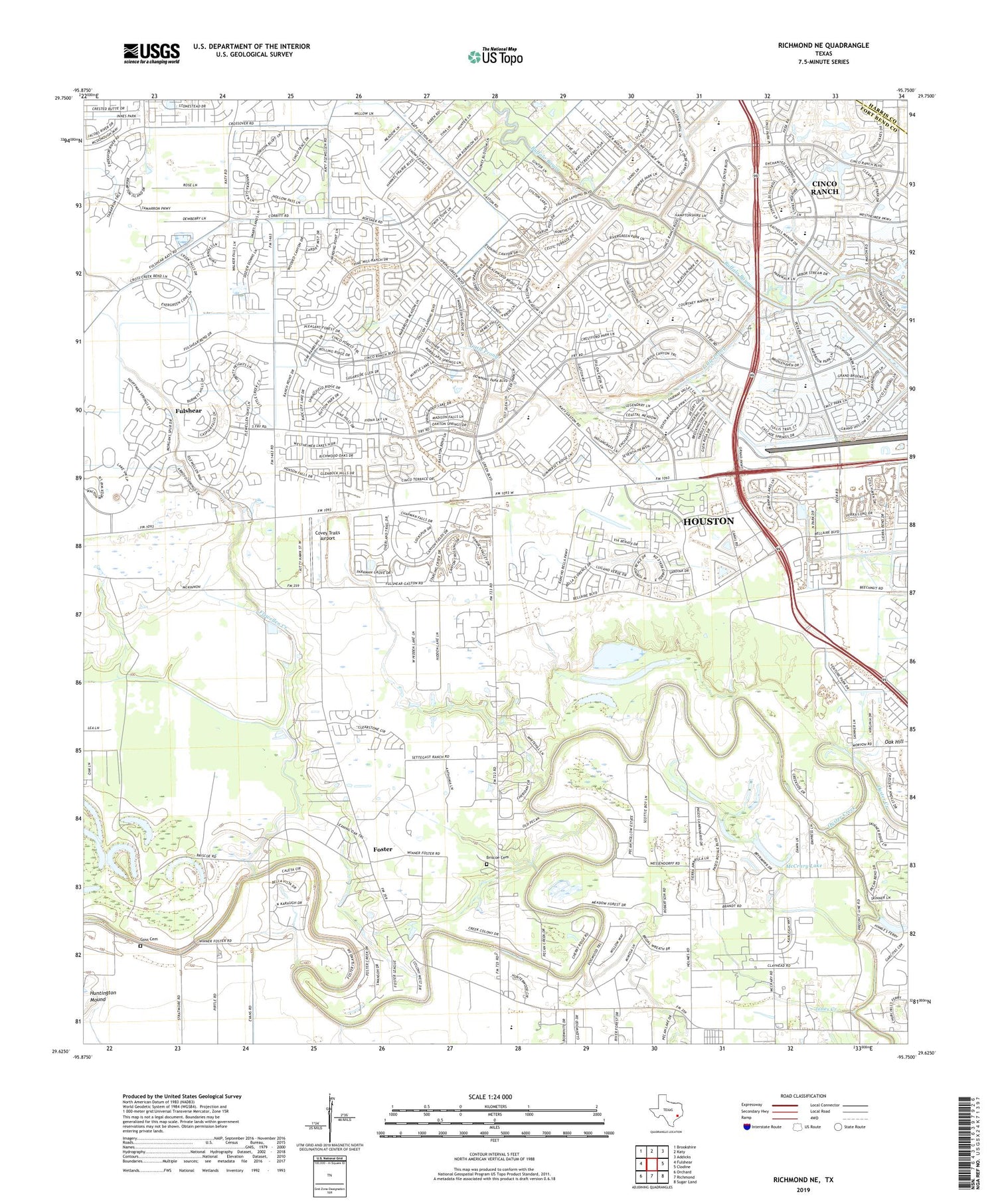
2019 topographic map quadrangle Richmond NE in the state of Texas. Scale: 1:24000. Based on the newly updated USGS 7.5' US Topo map series, this map is in the following counties: Fort Bend, Harris. The map contains contour data, water features, and other items you are used to seeing on USGS maps, but also has updated roads and other features. This is the next generation of topographic maps. Printed on high-quality waterproof paper with UV fade-resistant inks.
Quads adjacent to this one:
West: Fulshear
Northwest: Brookshire
North: Katy
Northeast: Addicks
East: Clodine
Southeast: Sugar Land
South: Richmond
Southwest: Orchard
Contains the following named places: Briscoe Cemetery, Cardiff Brothers Airport, Cinco Ranch, Cinco Ranch Census Designated Place, Cinco Ranch High School, City of Fulshear, Covey Trails Airport, Dewberry Heliport, Flewellen Creek, Fort Bend County Constable's Office Precinct 3, Fort Bend County Emergency Service District 2, Fort Bend WCID 1 Old Second Lift Dam, Foster, Fulshear Oil Field, Fulshear-Simonton Division, George Ranch Historical Park Museum, Goss Cemetery, Grace Community Bible Church, Grace Fellowship United Methdist Church, Heritage Ranch Airport, Huntington Mound, KMIA-FM (Rosenberg), Little Prong, Living Word Lutheran Church, McCrary Lake, Oak Hill, Oak Hill Church, Pageville Church, Rodger and Ellen Beck Junior High School, Roosevelt Alexander Elementary School, Saint John Old South Anglican Catholic Church, Spring Green Church, Swinging Door Heliport, The Church Fellowship - Cinco Ranch, The Museum of Southern History, West Cinco Ranch Lake, West Cinco Ranch Lake Dam, Westheimer Air Park, Wilderness Church, ZIP Codes: 77406, 77494


