MyTopo
Rosser Texas US Topo Map
Couldn't load pickup availability
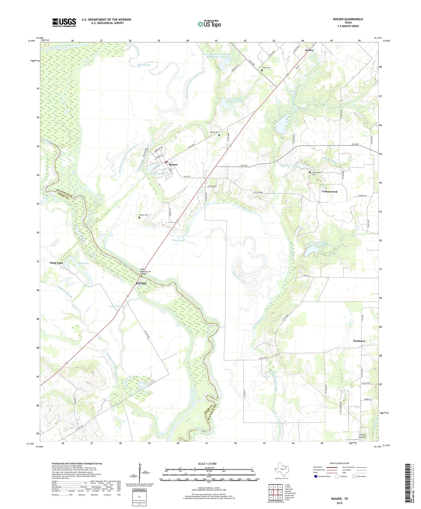
2019 topographic map quadrangle Rosser in the state of Texas. Scale: 1:24000. Based on the newly updated USGS 7.5' US Topo map series, this map is in the following counties: Kaufman, Ellis. The map contains contour data, water features, and other items you are used to seeing on USGS maps, but also has updated roads and other features. This is the next generation of topographic maps. Printed on high-quality waterproof paper with UV fade-resistant inks.
Quads adjacent to this one:
West: Bristol
Northwest: India
North: Scurry
Northeast: Kaufman
East: Grays Prairie
Southeast: Styx
South: Rosser SW
Southwest: Ennis East
Contains the following named places: Ashton Lake, Big Sandy Creek, City of Cottonwood, Coal Iron Creek, Connies Aviation, Cottonwood, Cottonwood Cemetery, Cottonwood Church, Cutoff Slough, Deadman Slough, Ezell Slough, Four Wire Lake, Green Cemetery, Hillside Diversion Terrace, Holiness Church, Hugghins Dam, Hugghins Lake, Lateral Site Number Twelve, Lateral Site Number Two, Lock Number 7, Lower East Fork Lateral Site Number Eleven, Mount Horeb Church, Mount Olive Church, Old Channel East Fork Trinity River, Peeltown, Peters Lake, Rosser, Rosser Cemetery, Rosser Post Office, Rosser Volunteer Fire Department, Sand Lake, Sand Pit Lake, Scurry - Rosser High School, Scurry - Rosser Middle School, Scurry-Rosser School, Soil Conservation Service Site 1 Dam, Soil Conservation Service Site 1 Reservoir, Soil Conservation Service Site 11 Dam, Soil Conservation Service Site 2 Dam, Soil Conservation Service Site 2 Reservoir, State Highway 34 Bridge, Village of Rosser, Wilson Chapel Church, ZIP Codes: 75157, 75158