MyTopo
Scurry Texas US Topo Map
Couldn't load pickup availability
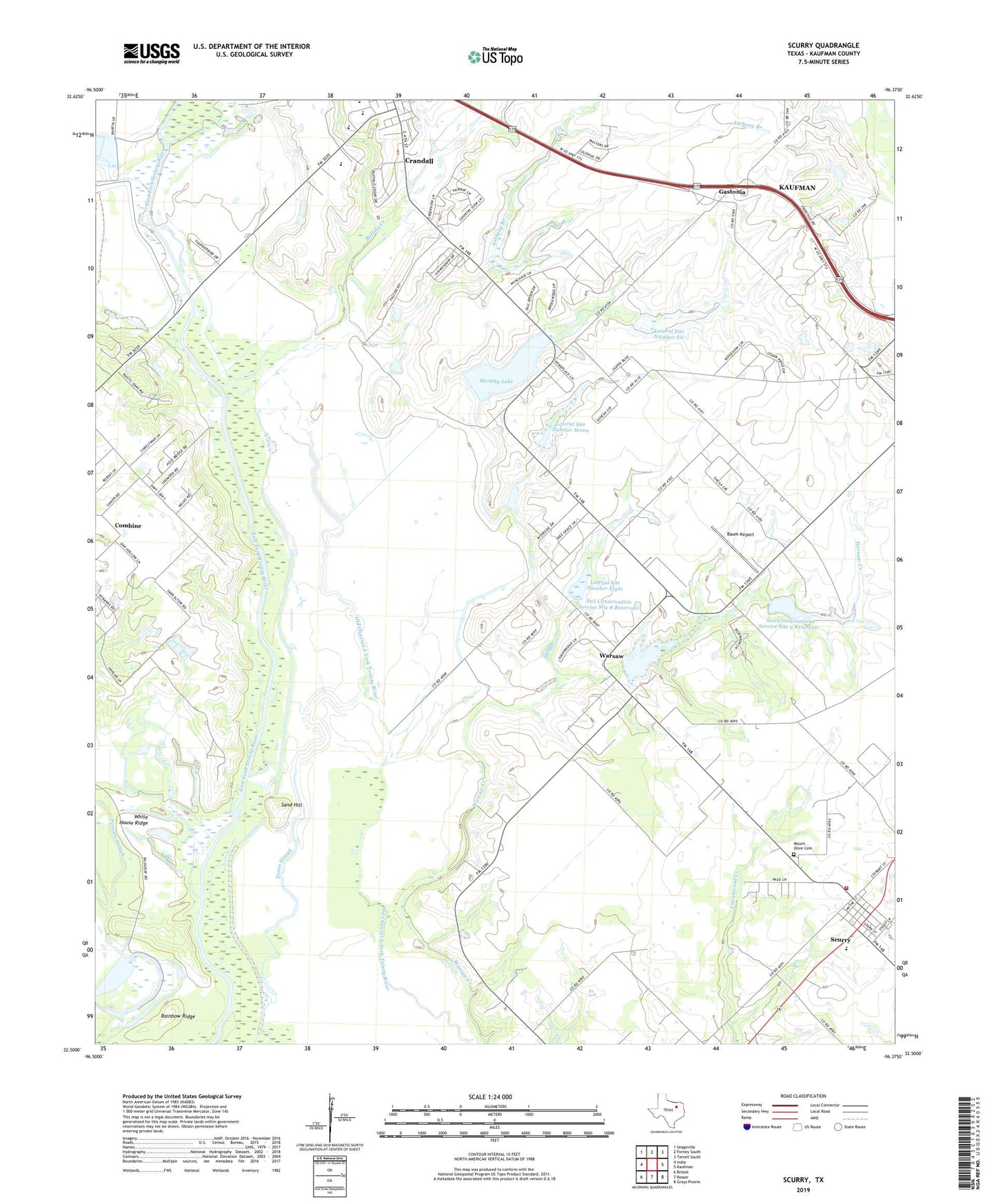
2022 topographic map quadrangle Scurry in the state of Texas. Scale: 1:24000. Based on the newly updated USGS 7.5' US Topo map series, this map is in the following counties: Kaufman. The map contains contour data, water features, and other items you are used to seeing on USGS maps, but also has updated roads and other features. This is the next generation of topographic maps. Printed on high-quality waterproof paper with UV fade-resistant inks.
Quads adjacent to this one:
West: India
Northwest: Seagoville
North: Forney South
Northeast: Terrell South
East: Kaufman
Southeast: Grays Prairie
South: Rosser
Southwest: Bristol
This map covers the same area as the classic USGS quad with code o32096e4.
Contains the following named places: Anthony Branch, Baum Airport, Buffalo Creek, City of Crandall, Crandall Division, Gastonia, Lateral Site Number Eight, Lateral Site Number Eleven, Lateral Site Number Nine, Lateral Site Number Seven, Lateral Site Number Six, Lateral Site Number Ten, Lower East Fork Lateral Site Number Five, Mount Olive Cemetery, Murphy Lake, Murphy Lake Dam, Pecan Slough, Pirate Stadium, Pleasant Grove Church, Rainbow Ridge, Sand Hill, Scurry, Scurry Post Office, Scurry Volunteer Fire Department, Soil Conservation Service Site 10 Reservoir, Soil Conservation Service Site 5 Dam, Soil Conservation Service Site 6 Dam, Soil Conservation Service Site 7 Dam, Soil Conservation Service Site 8 Dam, Soil Conservation Service Site 8 Reservoir, Soil Conservation Service Site 9 Dam, Soil Conservation Service Site 9 Reservoir, Thunderbird Racetrack, Town of Scurry, Valley Ranch, Warsaw, Warsaw Center, Warsaw Creek, White House Ridge, ZIP Code: 75114