
MyTopo
Rucker Texas US Topo Map
Couldn't load pickup availability
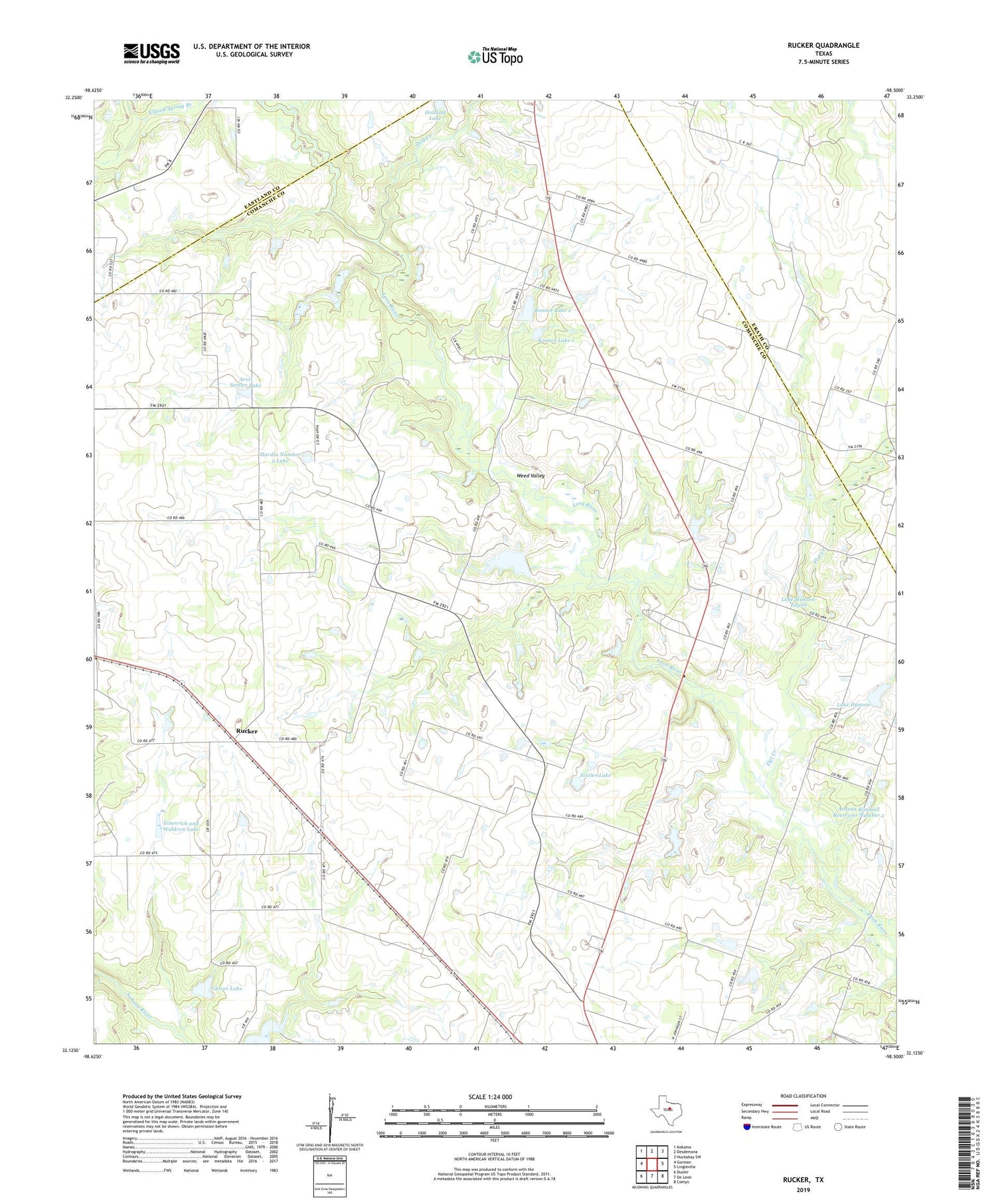
2019 topographic map quadrangle Rucker in the state of Texas. Scale: 1:24000. Based on the newly updated USGS 7.5' US Topo map series, this map is in the following counties: Comanche, Erath, Eastland. The map contains contour data, water features, and other items you are used to seeing on USGS maps, but also has updated roads and other features. This is the next generation of topographic maps. Printed on high-quality waterproof paper with UV fade-resistant inks.
Quads adjacent to this one:
West: Gorman
Northwest: Kokomo
North: Desdemona
Northeast: Huckabay SW
East: Lingleville
Southeast: Comyn
South: De Leon
Southwest: Duster
Contains the following named places: Ardean Kimmell Dam Number 2, Ardean Kimmell Reservoir Number 2, Arvil Setzler Dam, Arvil Setzler Lake, De Leon Pumping Station, Eisenrich and Waldron Dam, Eisenrich and Waldron Lake, Flat Creek, Gilder Dam, Gilder Lake, Glover Dam, Glover Lake, Hardin Number 2 Dam, Hardin Number 2 Lake, Hog Creek, Holland Lake Dam, Koonce Dam 1, Koonce Dam 2, Koonce Lake 1, Koonce Lake 2, Lake Hanson, Lake Hanson Dam, Lake Hanson-Taylor, Lake Hanson-Taylor Dam, Liberty Church, Oliver Springs Church, Rucker, Setzler Dam, Setzler Lake, Weed Valley


