MyTopo
San Angelo North Texas US Topo Map
Couldn't load pickup availability
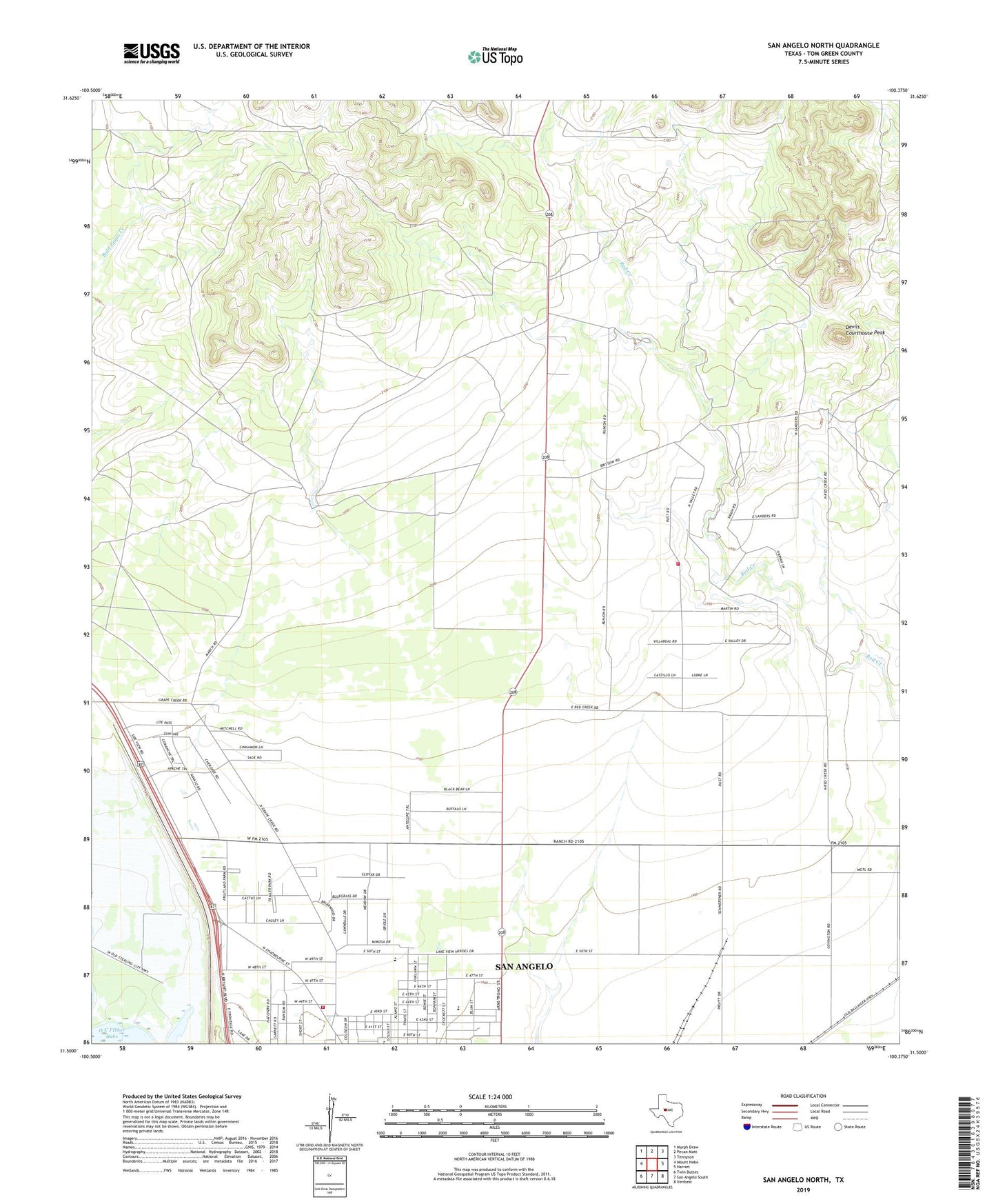
2019 topographic map quadrangle San Angelo North in the state of Texas. Scale: 1:24000. Based on the newly updated USGS 7.5' US Topo map series, this map is in the following counties: Tom Green. The map contains contour data, water features, and other items you are used to seeing on USGS maps, but also has updated roads and other features. This is the next generation of topographic maps. Printed on high-quality waterproof paper with UV fade-resistant inks.
Quads adjacent to this one:
West: Mount Nebo
Northwest: Murph Draw
North: Pecan Mott
Northeast: Tennyson
East: Harriet
Southeast: Veribest
South: San Angelo South
Southwest: Twin Buttes
Contains the following named places: Cactus Lane Park, Devils Courthouse Peak, KACB-TV (San Angelo), Lake View High School, Lake View School, Lake View Stadium, Lake View United Methodist Church, Lakeview Holiness Church, Lincoln Junior High School, Northridge Baptist Church, Quail Baptist Church, Quail Valley Volunteer Fire Department, Red Creek School, San Angelo Coliseum, San Angelo Fairgrounds, San Angelo Fire Department Station 6