MyTopo
Veribest Texas US Topo Map
Couldn't load pickup availability
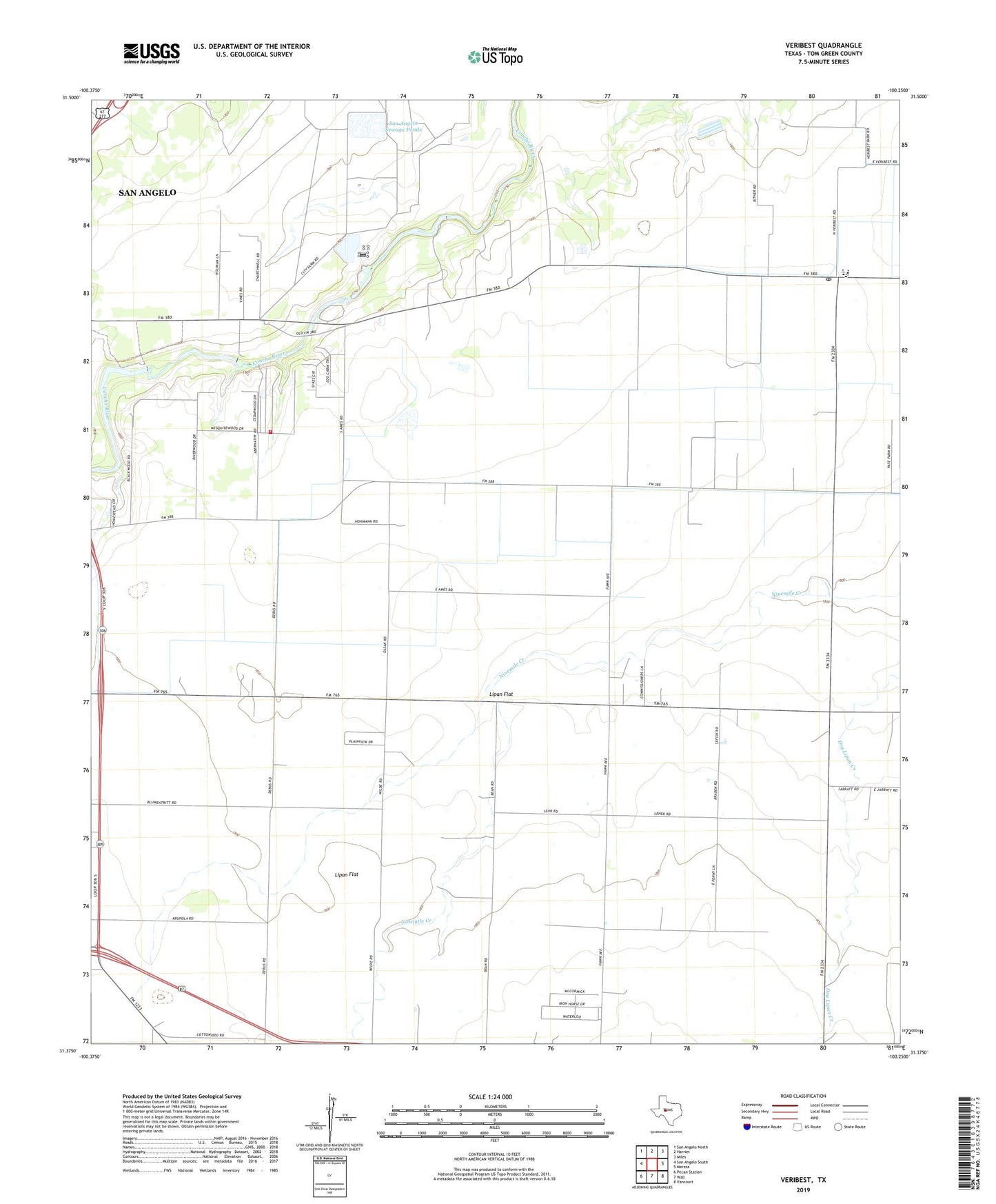
2022 topographic map quadrangle Veribest in the state of Texas. Scale: 1:24000. Based on the newly updated USGS 7.5' US Topo map series, this map is in the following counties: Tom Green. The map contains contour data, water features, and other items you are used to seeing on USGS maps, but also has updated roads and other features. This is the next generation of topographic maps. Printed on high-quality waterproof paper with UV fade-resistant inks.
Quads adjacent to this one:
West: San Angelo South
Northwest: San Angelo North
North: Harriet
Northeast: Miles
East: Mereta
Southeast: Vancourt
South: Wall
Southwest: Pecan Station
This map covers the same area as the classic USGS quad with code o31100d3.
Contains the following named places: Byrd School, City of San Angelo Sewage Ponds Dam, East Concho Volunteer Fire Department, East Tom Green Division, Johnson Dam, Johnson Lake, Kaase Dam, Kaase Reservoir, Lipan Flat, San Angelo Sewage Ponds, Sixmile Crossing, Veribest, Veribest Post Office