MyTopo
Harriet Texas US Topo Map
Couldn't load pickup availability
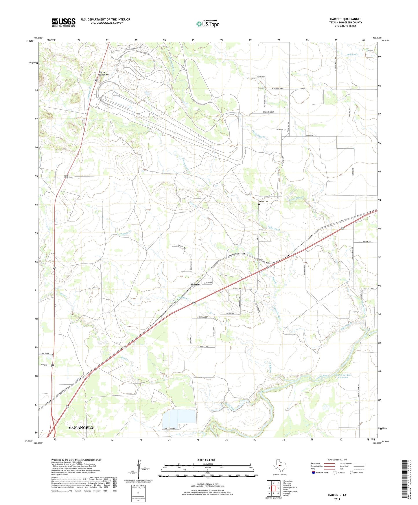
2022 topographic map quadrangle Harriet in the state of Texas. Scale: 1:24000. Based on the newly updated USGS 7.5' US Topo map series, this map is in the following counties: Tom Green. The map contains contour data, water features, and other items you are used to seeing on USGS maps, but also has updated roads and other features. This is the next generation of topographic maps. Printed on high-quality waterproof paper with UV fade-resistant inks.
Quads adjacent to this one:
West: San Angelo North
Northwest: Pecan Mott
North: Tennyson
Northeast: Miles NW
East: Miles
Southeast: Mereta
South: Veribest
Southwest: San Angelo South
This map covers the same area as the classic USGS quad with code o31100e3.
Contains the following named places: Burner Farm Airport, Crows Nest Creek, Erwin-Jordan Dam, Erwin-Jordan Reservoir, Harriet, Harriet Cemetery, Harriet School, Harriett Baptist Church, Kiesling, Kiesling School, Krall Dam, Krall Reservoir, Little Crows Nest Creek, Rattle Snake Hill, Red Creek, Sales Branch, Tenmile Creek, Valentine Branch, ZIP Code: 76905