MyTopo
San Jacinto Texas US Topo Map
Couldn't load pickup availability
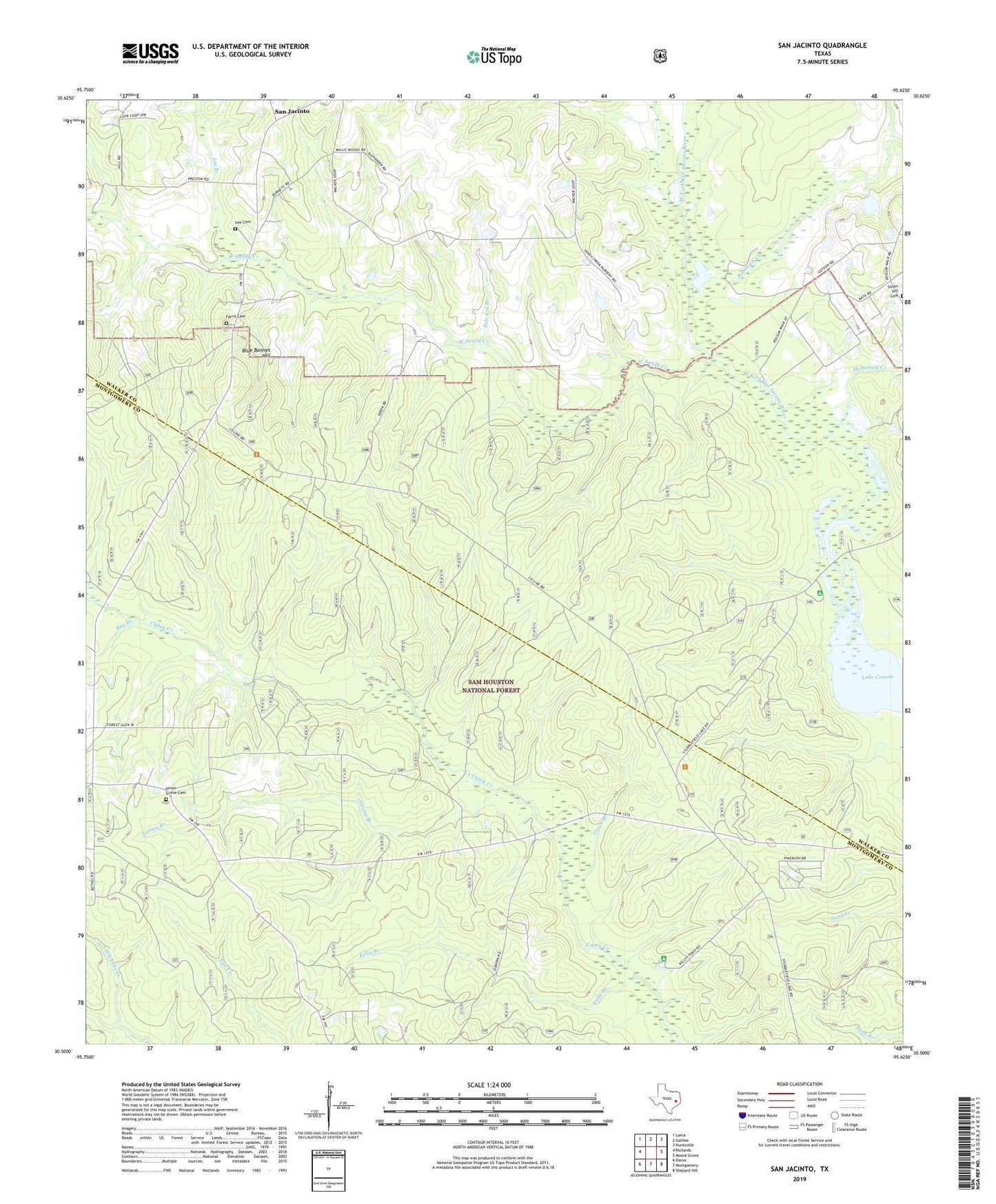
2019 topographic map quadrangle San Jacinto in the state of Texas. Scale: 1:24000. Based on the newly updated USGS 7.5' US Topo map series, this map is in the following counties: Montgomery, Walker. The map contains contour data, water features, and other items you are used to seeing on USGS maps, but also has updated roads and other features. This is the next generation of topographic maps. Printed on high-quality waterproof paper with UV fade-resistant inks.
Quads adjacent to this one:
West: Richards
Northwest: Loma
North: Galilee
Northeast: Huntsville
East: Moore Grove
Southeast: Shepard Hill
South: Montgomery
Southwest: Dacus
Contains the following named places: Antony Branch, Bay Branch, Blue Bonnet Hill, Ebenezer Church, Farris Cemetery, Farris Chapel, Goshen, Green Branch, Kelly Branch, Kellys Pond Recreation Site, Lee Branch, Lee Cemetery, Little Zion School, McDonald Creek, Mount Prairie Church, Pole Cat Branch, Pool Lookout, Robinson Creek, San Jacinto, Stubblefield Lake Trail, Stubblefield Recreation Site, Union Grove Cemetery, Union Grove Church, Union Hill Church, West Sandy Creek