MyTopo
San Martine Texas US Topo Map
Couldn't load pickup availability
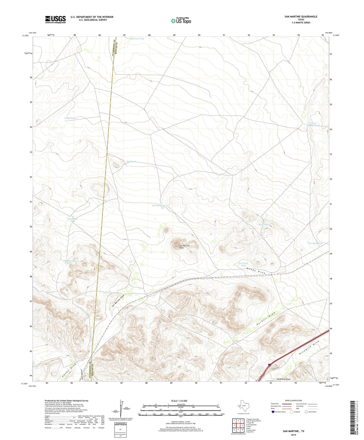
2019 topographic map quadrangle San Martine in the state of Texas. Scale: 1:24000. Based on the newly updated USGS 7.5' US Topo map series, this map is in the following counties: Reeves, Culberson. The map contains contour data, water features, and other items you are used to seeing on USGS maps, but also has updated roads and other features. This is the next generation of topographic maps. Printed on high-quality waterproof paper with UV fade-resistant inks.
Quads adjacent to this one:
West: Iron Mountain
Northwest: Hopper Draw East
North: Burnt Spring Hills SE
Northeast: Toyah SW
East: Gozar
Southeast: Sotol Hill
South: Gomez Peak
Southwest: Kent
Contains the following named places: Adobe Draw, Antelope Draw, Axtell Tank, Bankhead Draw, Bull Tank, Bull Windmill, Challenge Tank, Clay Tank, Corral Windmill, Dead Cow Tank, Goldwater Tank, Gun Barrel Windmill, Harwell Windmill, Ice Cream Tank, Joans Windmill, Middle Windmill, Oil Well Tank, Railroad Windmill, Red Windmill, San Martine, San Martine Peak, San Martine Windmill, Seven Heart Crossing, T Diamond Ranch, Three Corners Tank, Two Duck Tank