MyTopo
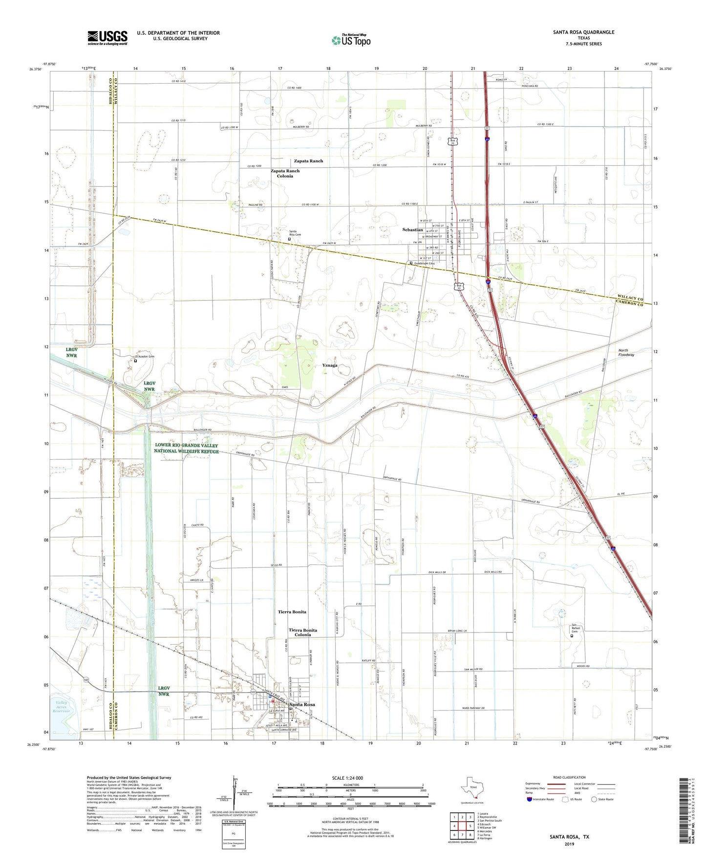
Santa Rosa Texas US Topo Map
Couldn't load pickup availability
2022 topographic map quadrangle Santa Rosa in the state of Texas. Scale: 1:24000. Based on the newly updated USGS 7.5' US Topo map series, this map is in the following counties: Cameron, Willacy, Hidalgo. The map contains contour data, water features, and other items you are used to seeing on USGS maps, but also has updated roads and other features. This is the next generation of topographic maps. Printed on high-quality waterproof paper with UV fade-resistant inks.
Quads adjacent to this one:
West: Edcouch
Northwest: Lasara
North: Raymondville
Northeast: San Perlita South
East: Willamar SW
Southeast: Harlingen
South: La Feria
Southwest: Mercedes
This map covers the same area as the classic USGS quad with code o26097c7.
Contains the following named places: East Cantu Road Colonia, El Azadon Cemetery, El Nogal Colonia, Guadalupe Cemetery, Hugh Terry Colonia, La Kinina Colonia, Las Palomas Wildlife Management Area - Frederick Unit, Las Palomas Wildlife Management Area - Longoria Unit, North Floodway, S and C Colonia, San Pedro Cemetery, Santa Rita Cemetery, Santa Rosa, Santa Rosa Elementary School, Santa Rosa High School, Santa Rosa Middle School, Santa Rosa Number 5 Colonia, Santa Rosa Number 9 Colonia, Santa Rosa Police Department, Santa Rosa Post Office, Santa Rosa Volunteer Fire Department, Sebastian, Sebastian Census Designated Place, Sebastian Elementary School, Sebastian Post Office, Tierra Bonita, Tierra Bonita Census Designated Place, Tierra Bonita Colonia, Tierra Bonita Number 2 Colonia, Town of Santa Rosa, Willacy Canal, Yznaga, Yznaga Census Designated Place, Yznaga Number 1 Colonia, Yznaga Number 2 Colonia, Zapata Ranch, Zapata Ranch Census Designated Place, Zapata Ranch Colonia, ZIP Codes: 78593, 78594