MyTopo
San Perlita South Texas US Topo Map
Couldn't load pickup availability
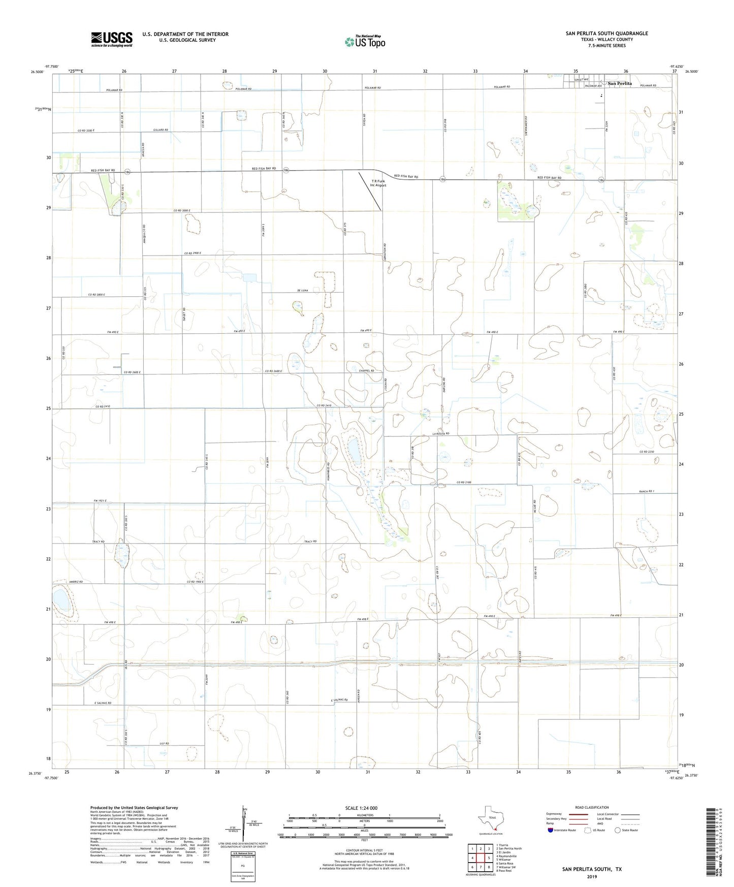
2022 topographic map quadrangle San Perlita South in the state of Texas. Scale: 1:24000. Based on the newly updated USGS 7.5' US Topo map series, this map is in the following counties: Willacy. The map contains contour data, water features, and other items you are used to seeing on USGS maps, but also has updated roads and other features. This is the next generation of topographic maps. Printed on high-quality waterproof paper with UV fade-resistant inks.
Quads adjacent to this one:
West: Raymondville
Northwest: Yturria
North: San Perlita North
Northeast: El Jardin
East: Willamar
Southeast: Paso Real
South: Willamar SW
Southwest: Santa Rosa
This map covers the same area as the classic USGS quad with code o26097d6.
Contains the following named places: Los Coyotes, Los Coyotes Gin, Lyford Division, San Perlita City Hall, San Perlita Elementary School, San Perlita High School, San Perlita Middle School, T R Funk Inc Airport, ZIP Code: 78580