MyTopo
Lasara Texas US Topo Map
Couldn't load pickup availability
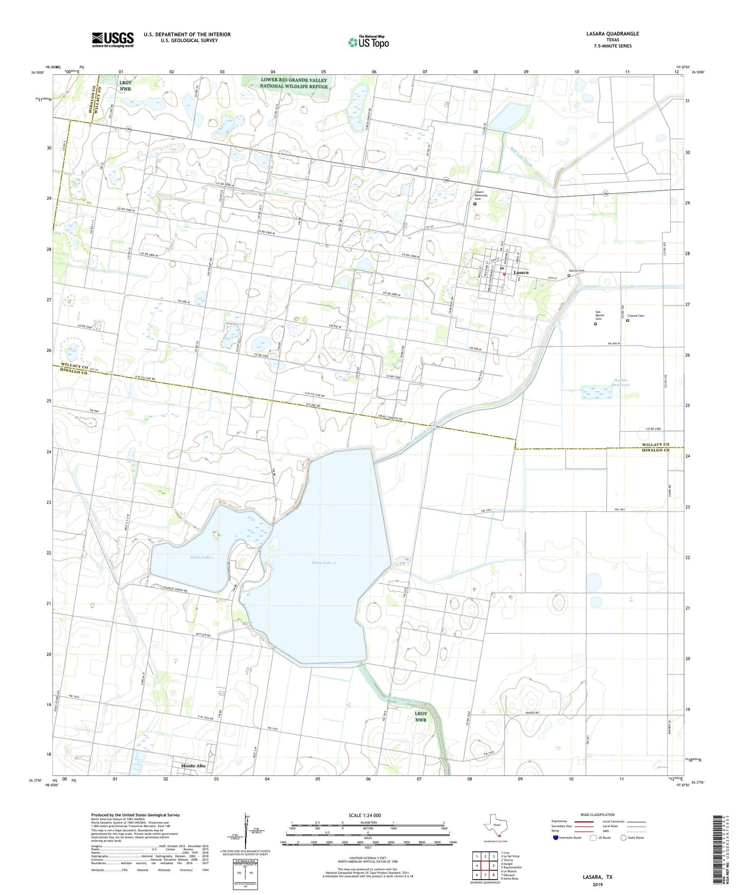
2022 topographic map quadrangle Lasara in the state of Texas. Scale: 1:24000. Based on the newly updated USGS 7.5' US Topo map series, this map is in the following counties: Hidalgo, Willacy. The map contains contour data, water features, and other items you are used to seeing on USGS maps, but also has updated roads and other features. This is the next generation of topographic maps. Printed on high-quality waterproof paper with UV fade-resistant inks.
Quads adjacent to this one:
West: Hargill
Northwest: Linn
North: La Sal Vieja
Northeast: Yturria
East: Raymondville
Southeast: Santa Rosa
South: Edcouch
Southwest: La Blanca
This map covers the same area as the classic USGS quad with code o26097d8.
Contains the following named places: Chavez Cemetery, Delta Lake, Delta Lake Dam 2, Delta Unit 1 Dam, Garcia Cemetery, Harbin Levee, Harbin Reservoir, Hargill Division, Hidalgo and Willacy Counties Water District, KGBT-AM (Harlingen), Lasara, Lasara Census Designated Place, Lasara Memorial Cemetery, Lasara Post Office, Lasara Volunteer Fire Department, Main Branch Northeast Canal, Main Supply Canal, Reservoir Unit Number One, Reservoir Unit Number Two, Salt Lake Drain, San Martin Cemetery, Stockholm, Teniente Wid Number 1 Lake, Teniente Wid Number 1 Lake Dam, ZIP Code: 78561