MyTopo
Sneed Mountain Texas US Topo Map
Couldn't load pickup availability
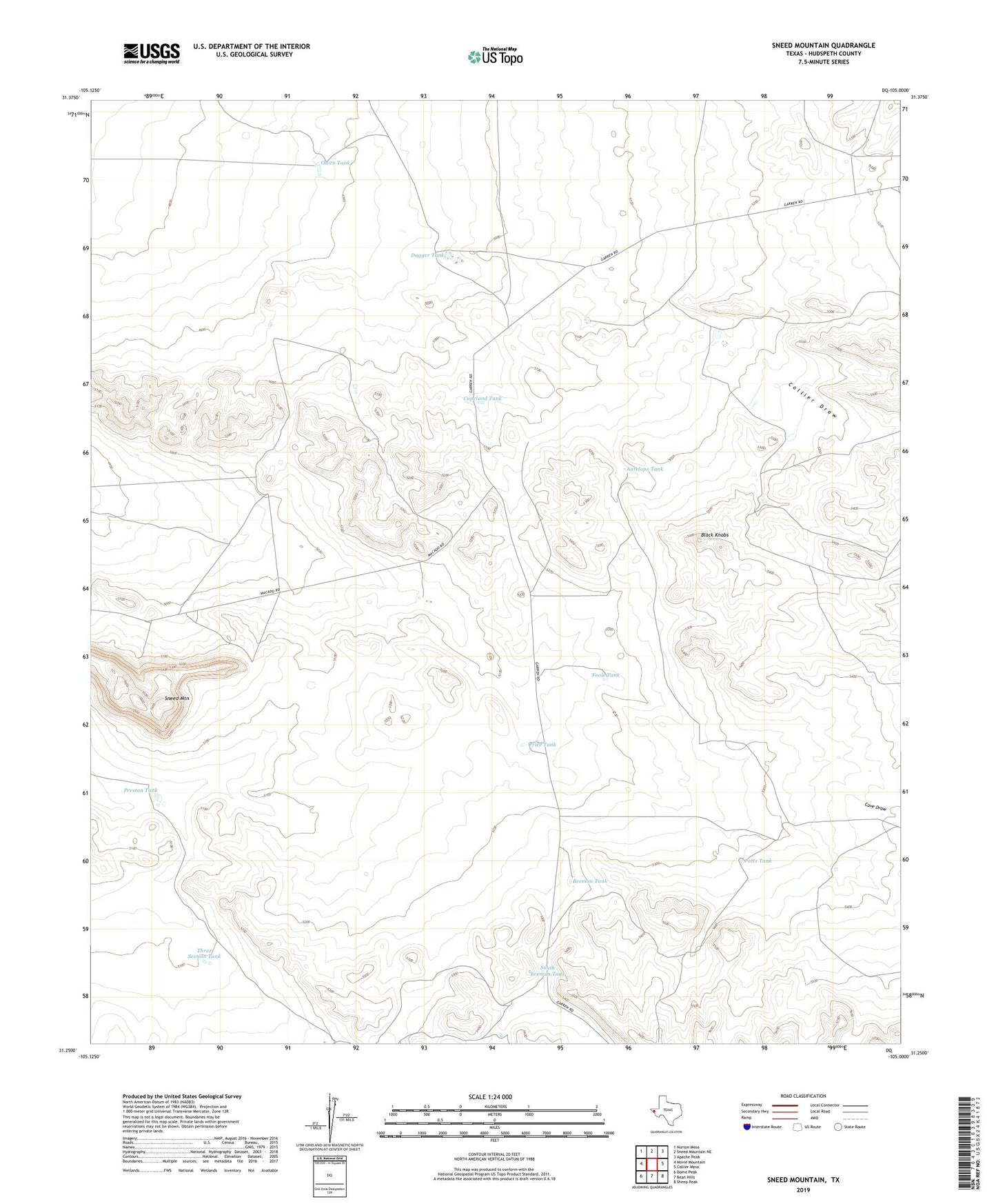
2022 topographic map quadrangle Sneed Mountain in the state of Texas. Scale: 1:24000. Based on the newly updated USGS 7.5' US Topo map series, this map is in the following counties: Hudspeth. The map contains contour data, water features, and other items you are used to seeing on USGS maps, but also has updated roads and other features. This is the next generation of topographic maps. Printed on high-quality waterproof paper with UV fade-resistant inks.
Quads adjacent to this one:
West: Movie Mountain
Northwest: Norton Mesa
North: Sneed Mountain NE
Northeast: Apache Peak
East: Collier Mesa
Southeast: Sheep Peak
South: Bean Hills
Southwest: Dome Peak
This map covers the same area as the classic USGS quad with code o31105c1.
Contains the following named places: Antelope Tank, Beeman Tank, Black Knobs, Cave Draw, Collier Draw, Copeland Tank, Dagger Tank, Fools Tank, G McAdoo Ranch, McAdoo Ranch Cemetery, Owen Tank, Potts Tank, Preston Tank, Price Tank, Reed Ranch, Sneed Mountain, South Beeman Tank, Three Section Tank