
MyTopo
Shipp Ranch Texas US Topo Map
Couldn't load pickup availability
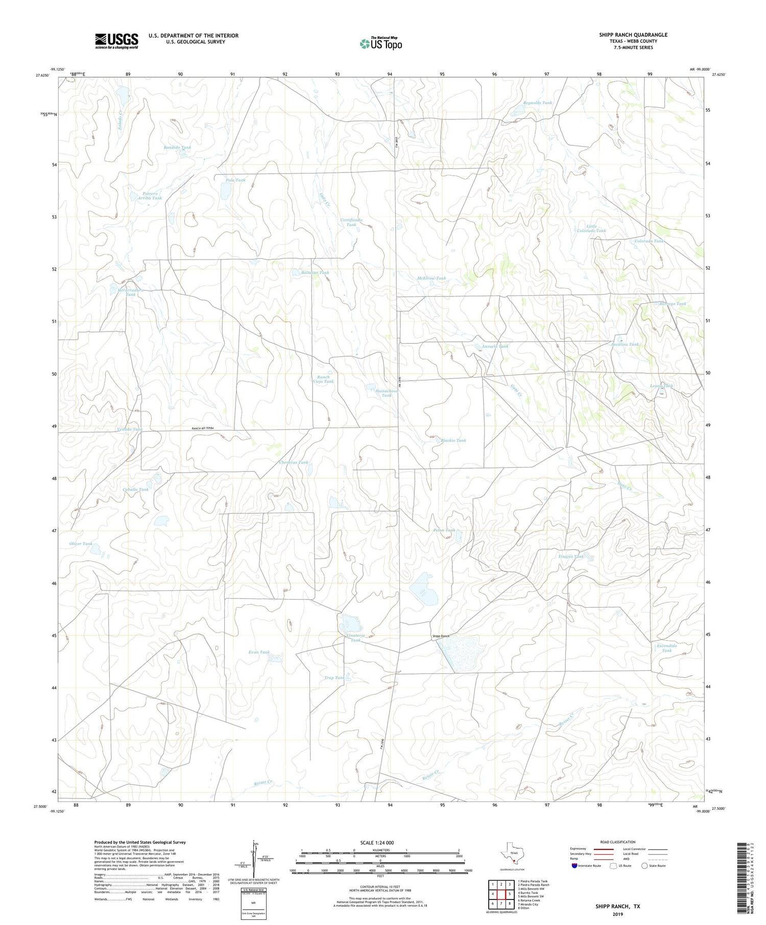
2019 topographic map quadrangle Shipp Ranch in the state of Texas. Scale: 1:24000. Based on the newly updated USGS 7.5' US Topo map series, this map is in the following counties: Webb. The map contains contour data, water features, and other items you are used to seeing on USGS maps, but also has updated roads and other features. This is the next generation of topographic maps. Printed on high-quality waterproof paper with UV fade-resistant inks.
Quads adjacent to this one:
West: Burrito Tank
Northwest: Piedra Parada Tank
North: Piedra Parada Ranch
Northeast: Mills Bennett NW
East: Mills Bennett SW
Southeast: Oilton
South: Mirando City
Southwest: Retama Creek
Contains the following named places: Anzuelo Tank, Baltazar Tank, Bandido Tank, Blackio Tank, Borrego Tank, Caballero Tank, Caballo Tank, Certificado Tank, Chenecas Tank, Colorado Tank, Escondido Tank, Evan Tank, Herarradura Tank, Huisachosa Tank, Javalina Tank, Leona Tank, Little Colorado Tank, McElrow Tank, Oliver Tank, Pelon Tank, Pola Tank, Potrero Arriba Tank, Quiros Lake, Quiros Lake Dam, Ranch Viejo Tank, Reynolds Tank, Shipp Ranch, Tinajas Tank, Trap Tank, Vaquillas Dam Number 2, Vaquillas Lake Number 1 Dam, Vaquillas Lake Number 2, Venado Tank, Vinateria Tank


