MyTopo
Smithville NW Texas US Topo Map
Couldn't load pickup availability
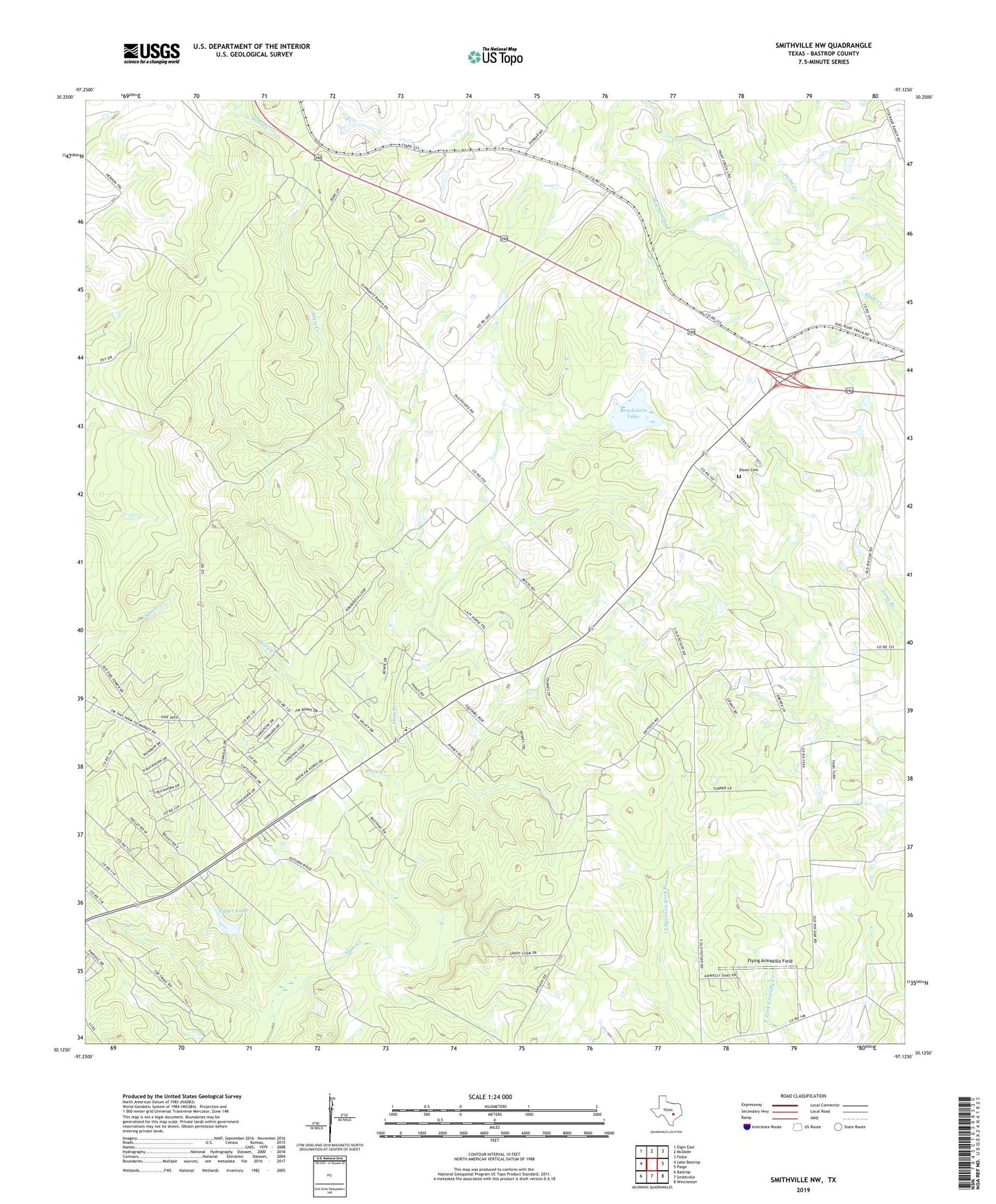
2022 topographic map quadrangle Smithville NW in the state of Texas. Scale: 1:24000. Based on the newly updated USGS 7.5' US Topo map series, this map is in the following counties: Bastrop. The map contains contour data, water features, and other items you are used to seeing on USGS maps, but also has updated roads and other features. This is the next generation of topographic maps. Printed on high-quality waterproof paper with UV fade-resistant inks.
Quads adjacent to this one:
West: Lake Bastrop
Northwest: Elgin East
North: McDade
Northeast: Fedor
East: Paige
Southeast: Winchester
South: Smithville
Southwest: Bastrop
This map covers the same area as the classic USGS quad with code o30097b2.
Contains the following named places: Bastrop Division, Brockstein Lake, Brockstein Lake Dam, Circle D Estates, Circle D-KC Estates Census Designated Place, Denton Public Library, Dixon Cemetery, Egger Lake, Egger Lake Dam, Flying Armadillo Field, KC Estates, Price Creek, Ridgeway Church, Ridgeway School, ZIP Code: 78659