MyTopo
White Hills Texas US Topo Map
Couldn't load pickup availability
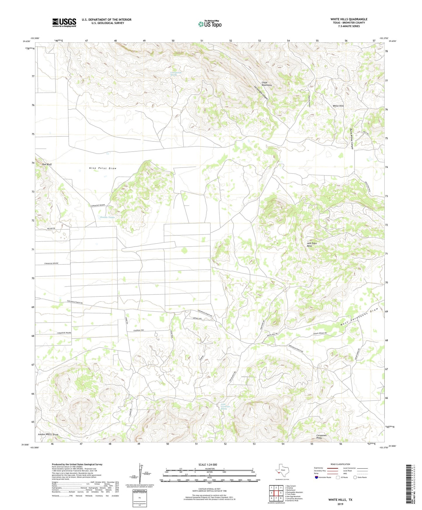
2022 topographic map quadrangle White Hills in the state of Texas. Scale: 1:24000. Based on the newly updated USGS 7.5' US Topo map series, this map is in the following counties: Brewster. The map contains contour data, water features, and other items you are used to seeing on USGS maps, but also has updated roads and other features. This is the next generation of topographic maps. Printed on high-quality waterproof paper with UV fade-resistant inks.
Quads adjacent to this one:
West: Packsaddle Mountain
Northwest: Dog Canyon
North: Graytop
Northeast: Butterbowl
East: Twin Peaks
Southeast: Sombrero Peak
South: Christmas Mountains
Southwest: Hen Egg Mountain
This map covers the same area as the classic USGS quad with code o29103e4.
Contains the following named places: Burnt Willow Canyon, Cartwright Canyon, Cottonwood Spring, Double Tanks, Jack Eden Mesa, Little Corazones Spring, Pipeline Canyon, Saucier Ranch