MyTopo
Stewards Mill Texas US Topo Map
Couldn't load pickup availability
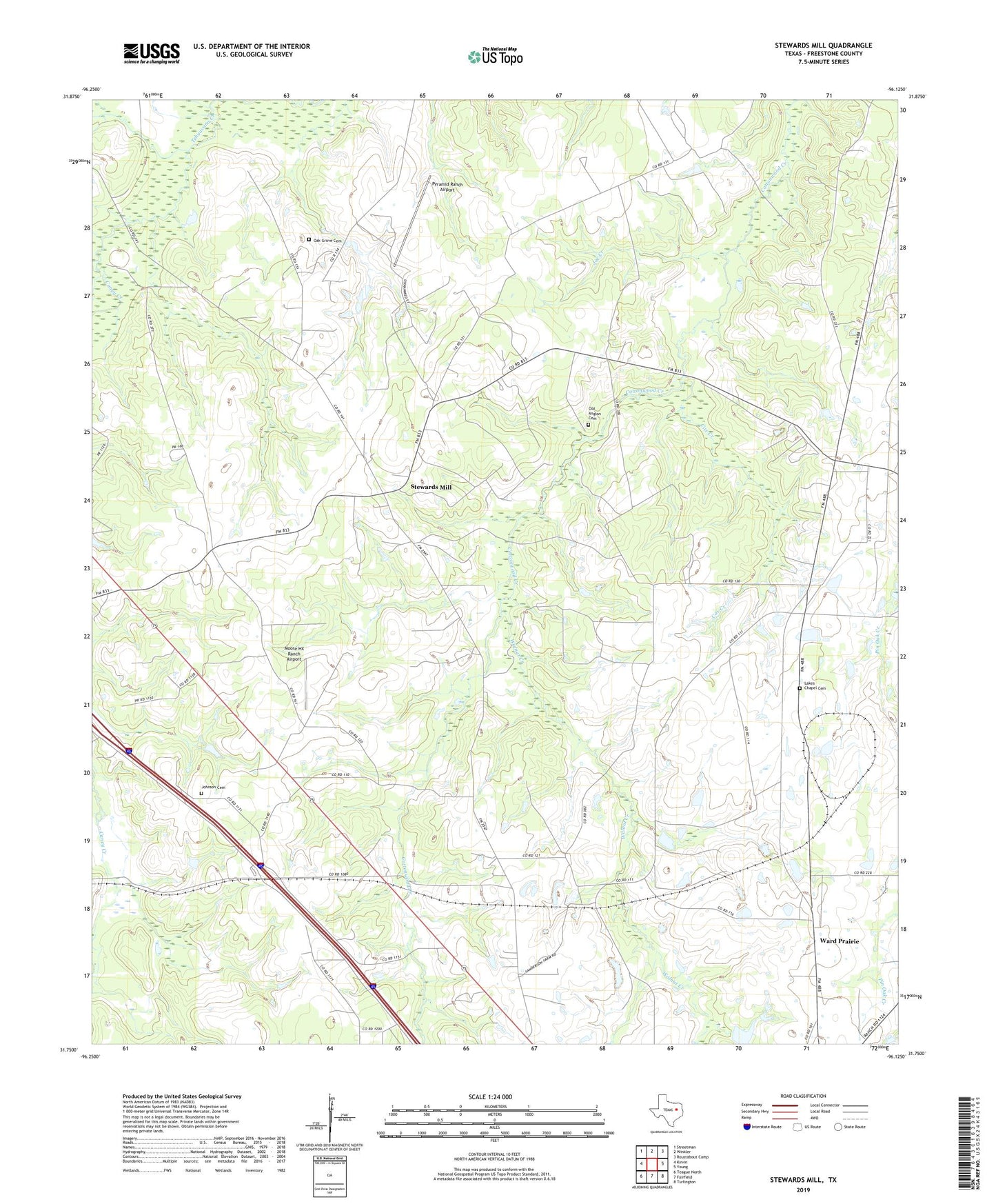
2019 topographic map quadrangle Stewards Mill in the state of Texas. Scale: 1:24000. Based on the newly updated USGS 7.5' US Topo map series, this map is in the following counties: Freestone. The map contains contour data, water features, and other items you are used to seeing on USGS maps, but also has updated roads and other features. This is the next generation of topographic maps. Printed on high-quality waterproof paper with UV fade-resistant inks.
Quads adjacent to this one:
West: Kirvin
Northwest: Streetman
North: Winkler
Northeast: Roustabout Camp
East: Young
Southeast: Turlington
South: Fairfield
Southwest: Teague North
Contains the following named places: Banks Stop, Bonnerville, Caney Creek, Cox Creek, Grindstone Creek, Joe Creek, Johnson Cemetery, Lakes Chapel Cemetery, Longs Church, Moore HX Ranch Airport, Oak Grove Cemetery, Old Anglin Cemetery, Pleasant Grove Church, Pyramid Ranch Airport, Rhode Island, Rhode Island Church, Stewards Mill, Union Chapel, Walnut Creek, Ward Prairie