MyTopo
Roustabout Camp Texas US Topo Map
Couldn't load pickup availability
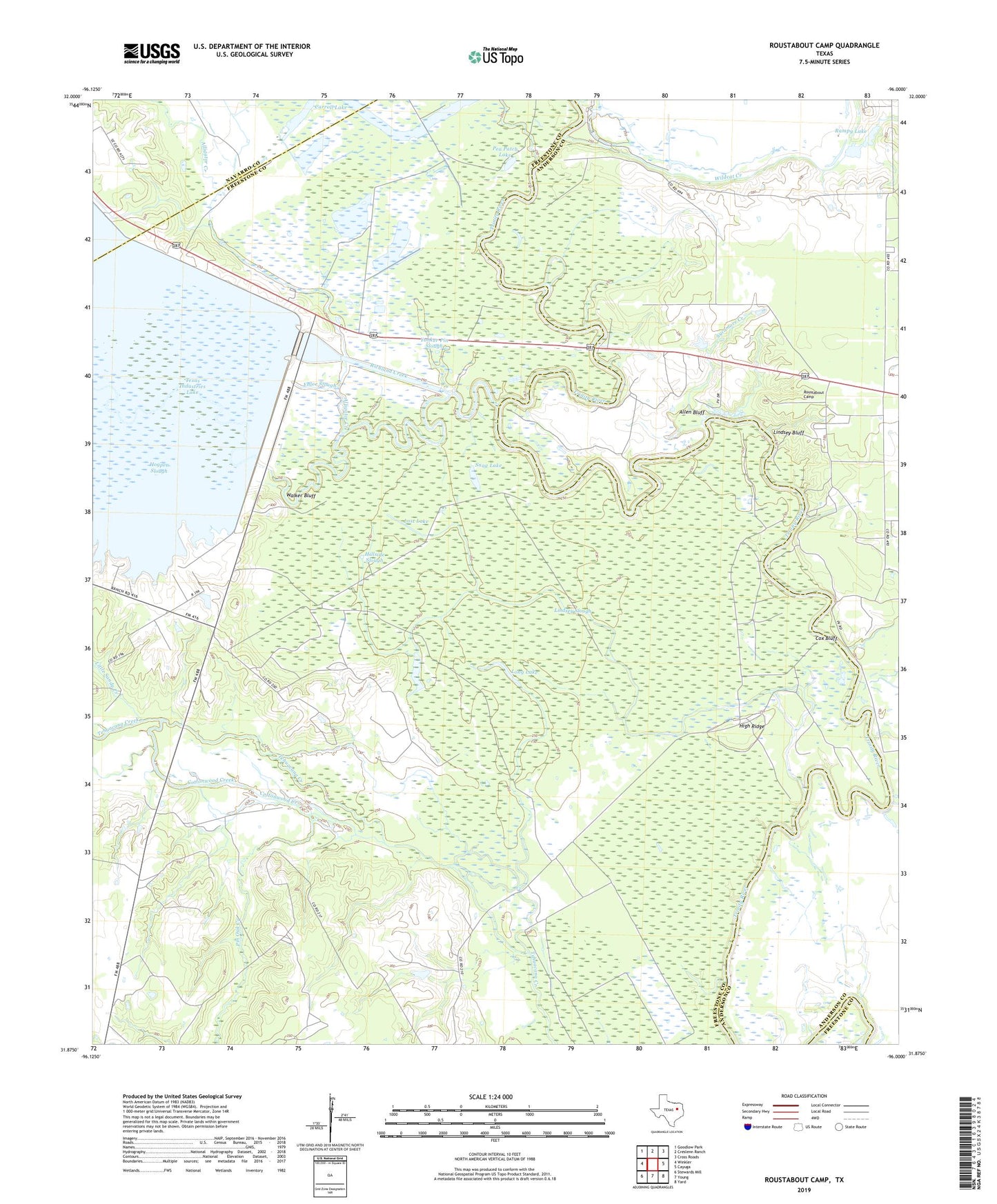
2022 topographic map quadrangle Roustabout Camp in the state of Texas. Scale: 1:24000. Based on the newly updated USGS 7.5' US Topo map series, this map is in the following counties: Freestone, Anderson, Navarro. The map contains contour data, water features, and other items you are used to seeing on USGS maps, but also has updated roads and other features. This is the next generation of topographic maps. Printed on high-quality waterproof paper with UV fade-resistant inks.
Quads adjacent to this one:
West: Winkler
Northwest: Goodlow Park
North: Creslenn Ranch
Northeast: Cross Roads
East: Cayuga
Southeast: Yard
South: Young
Southwest: Stewards Mill
This map covers the same area as the classic USGS quad with code o31096h1.
Contains the following named places: Allen Bluff, Alligator Creek, Amerada Camp, Big Camp, Carroll Lake, Cottonwood Creek, Cox Bluff, Enloe Slough, Harp Church, High Ridge, Hillside Slough, Lindsey Bluff, Lindsey Slough, Little Sandy Creek, Long Lake, Lost Lake, Pea Patch Lake, Pin Oak Creek, Prairie Creek, Rampy Lake, Richland Creek, Richland Creek Wildlife Management Area, Richland-Chambers Reservoir, Roustabout Camp, Snag Lake, Sycamore Creek, Walker Bluff, Walker Lake, Wildcat Creek, Yonker Pin Slough