
MyTopo
Tanglewood Texas US Topo Map
Couldn't load pickup availability
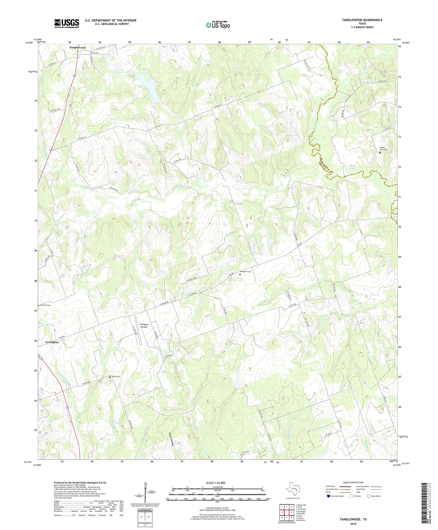
2019 topographic map quadrangle Tanglewood in the state of Texas. Scale: 1:24000. Based on the newly updated USGS 7.5' US Topo map series, this map is in the following counties: Lee, Burleson. The map contains contour data, water features, and other items you are used to seeing on USGS maps, but also has updated roads and other features. This is the next generation of topographic maps. Printed on high-quality waterproof paper with UV fade-resistant inks.
Quads adjacent to this one:
West: Lexington
Northwest: Alcoa Lake
North: Hicks
Northeast: Chriesman
East: Deanville
Southeast: Dime Box
South: Lincoln
Southwest: Fedor
Contains the following named places: Brushy Creek, Footprints Lake, Lexington Airfield, Little Brushy Creek, Lyles Cemetery, Mount Zion Cemetery, Phinney Lake Dam, Pleasant Grove, Pleasant Grove Church, Prospect Cemetery, Sand Lake, Tanglewood


