MyTopo
Wortham Texas US Topo Map
Couldn't load pickup availability
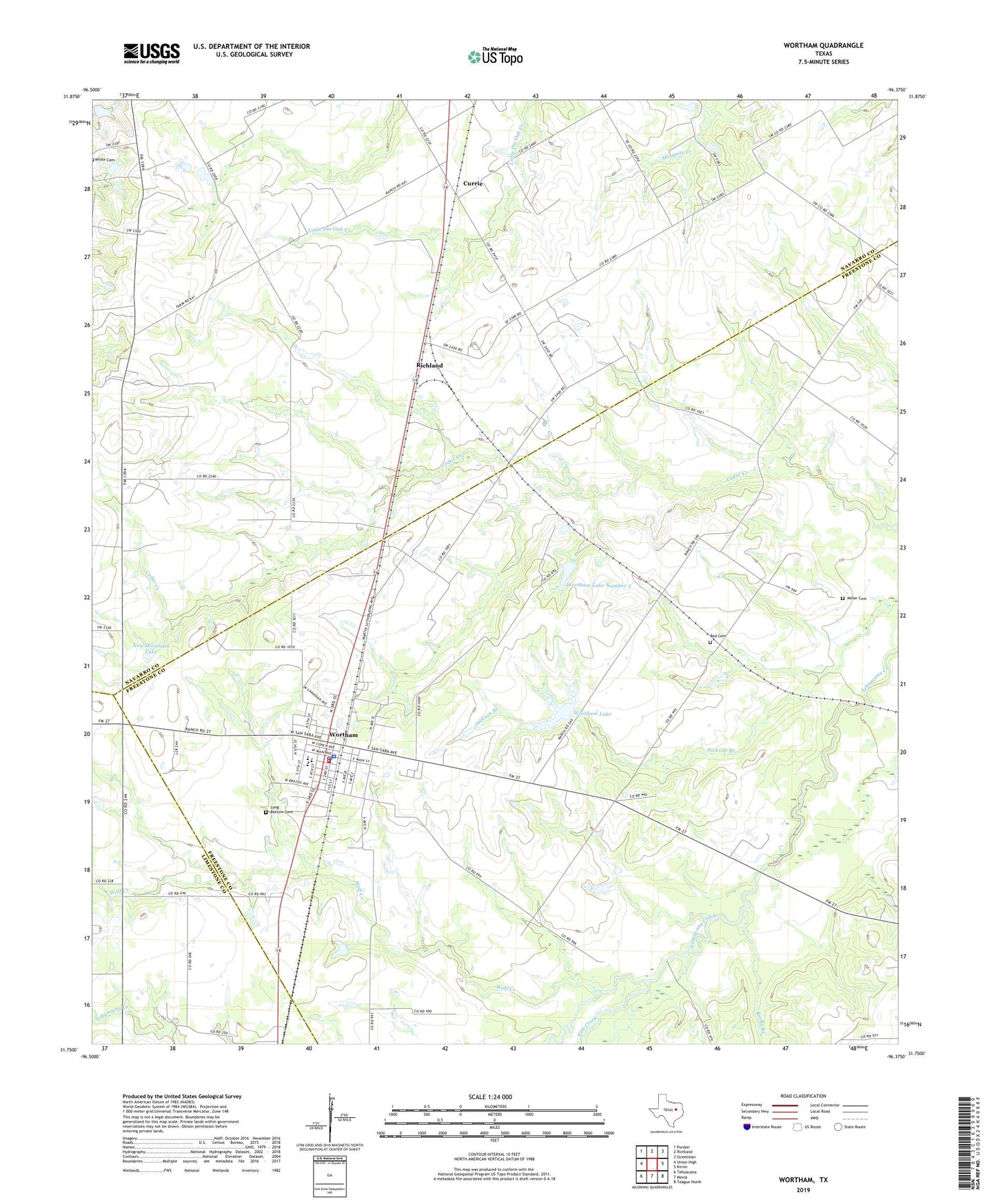
2022 topographic map quadrangle Wortham in the state of Texas. Scale: 1:24000. Based on the newly updated USGS 7.5' US Topo map series, this map is in the following counties: Freestone, Navarro, Limestone. The map contains contour data, water features, and other items you are used to seeing on USGS maps, but also has updated roads and other features. This is the next generation of topographic maps. Printed on high-quality waterproof paper with UV fade-resistant inks.
Quads adjacent to this one:
West: Union High
Northwest: Purdon
North: Richland
Northeast: Streetman
East: Kirvin
Southeast: Teague North
South: Mexia
Southwest: Tehuacana
This map covers the same area as the classic USGS quad with code o31096g4.
Contains the following named places: Currie, Currie Oil Field, Elm Creek, Gude, Long Bottom Cemetery, Miller Cemetery, New Wortham Lake, Red Cemetery, Rocky Branch, Tehuacana Oil Field, Town of Wortham, Wheeler High School, Wolf Creek, Wortham, Wortham City Hall, Wortham Lake, Wortham Lake Number 1 Dam, Wortham Lake Number 2, Wortham Lake Number 2 Dam, Wortham Oil Field, Wortham Police Department, Wortham Post Office, Wortham Volunteer Fire Department, ZIP Code: 76693