MyTopo
Telephone Texas US Topo Map
Couldn't load pickup availability
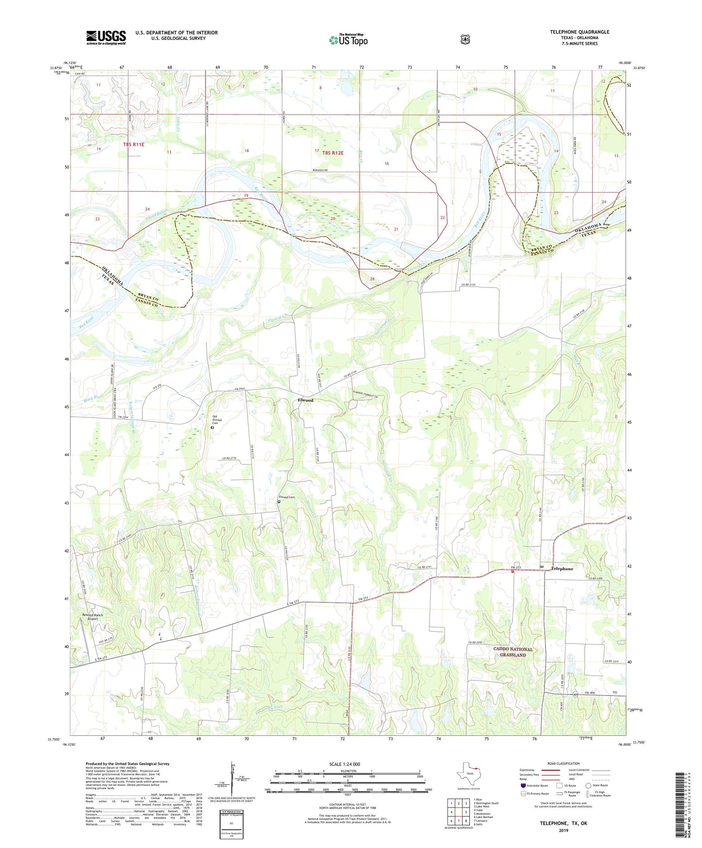
2019 topographic map quadrangle Telephone in the states of Texas, Oklahoma. Scale: 1:24000. Based on the newly updated USGS 7.5' US Topo map series, this map is in the following counties: Fannin, Bryan. The map contains contour data, water features, and other items you are used to seeing on USGS maps, but also has updated roads and other features. This is the next generation of topographic maps. Printed on high-quality waterproof paper with UV fade-resistant inks.
Quads adjacent to this one:
West: Yuba
Northwest: Blue
North: Bennington South
Northeast: Lake West
East: Monkstown
Southeast: Selfs
South: Lamasco
Southwest: Lake Bonham
Contains the following named places: Bethlehem Cemetery, Black Branch, Carman Lake Number 2, Carman Lake Number 2 Dam, Elwood, Elwood Cemetery, Elwood Creek, Island Bayou, Narvaugh Creek, Old Elwood Cemetery, Ravenna-Telephone Division, Reward Ranch Airport, Rice Creek, Robert Springs Branch, Roberts Springs Branch, Sam Rayburn Elementary School, Sam Rayburn High School, Telephone, Telephone Post Office, Telephone Volunteer Fire Department, Tuklo Creek, ZIP Code: 75447