
MyTopo
Thrifty Texas US Topo Map
Couldn't load pickup availability
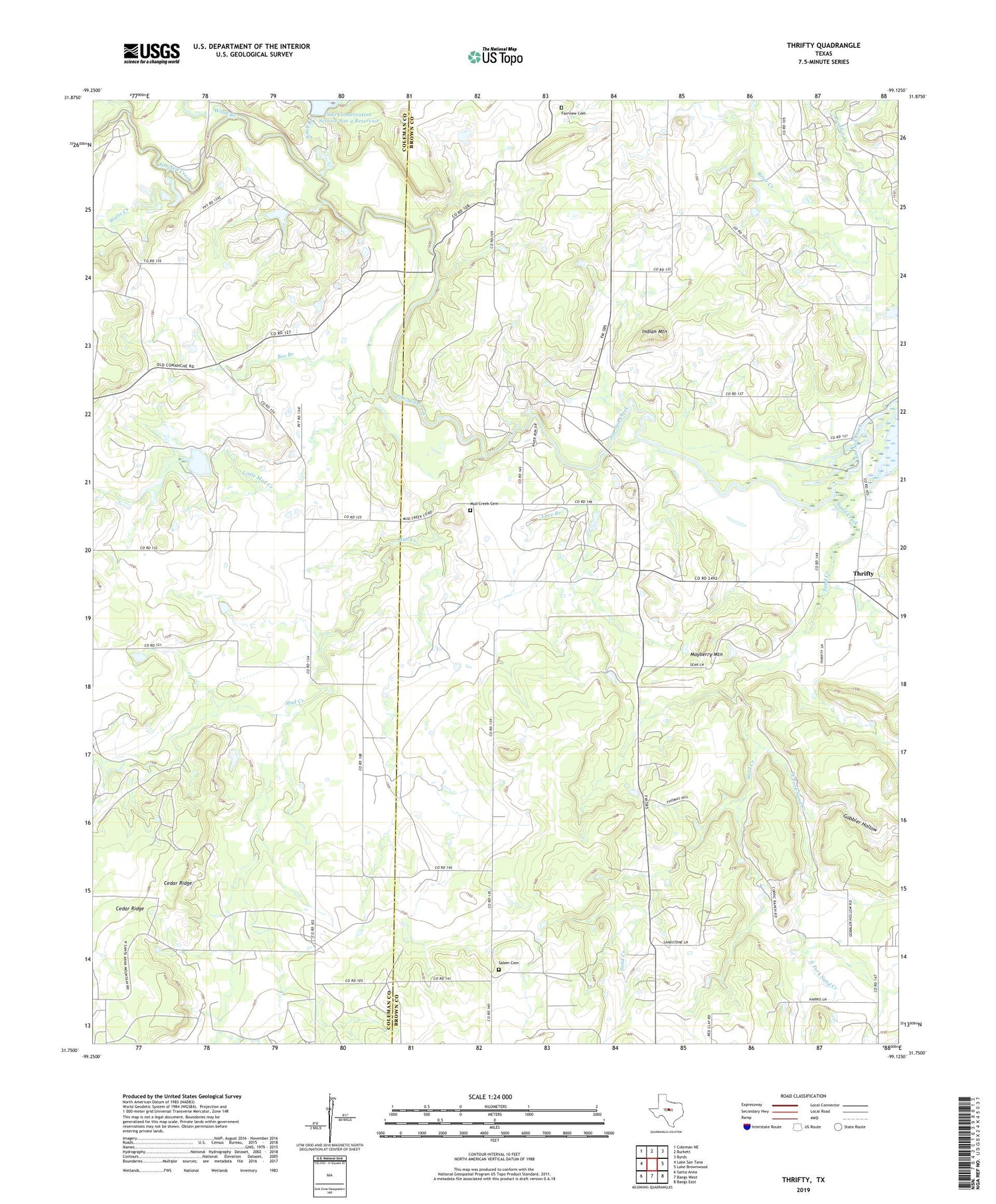
2019 topographic map quadrangle Thrifty in the state of Texas. Scale: 1:24000. Based on the newly updated USGS 7.5' US Topo map series, this map is in the following counties: Brown, Coleman. The map contains contour data, water features, and other items you are used to seeing on USGS maps, but also has updated roads and other features. This is the next generation of topographic maps. Printed on high-quality waterproof paper with UV fade-resistant inks.
Quads adjacent to this one:
West: Lake San Tana
Northwest: Coleman NE
North: Burkett
Northeast: Byrds
East: Lake Brownwood
Southeast: Bangs East
South: Bangs West
Southwest: Santa Anna
Contains the following named places: Bee Branch, Blackwell Crossing, Buffalo, Cedar Ridge, East Fork Sand Creek, Eureka Church, Fairview Cemetery, Fry, Gobbler Hollow, Indian Mountain, Knoll Branch, Little Mud Creek, Love Branch, Mayberry Mountain, Mud Creek, Mud Creek Cemetery, Salem Cemetery, Sand Creek, Soil Conservation Service Site 2 Dam, Soil Conservation Service Site 2 Reservoir, Soil Conservation Service Site 27 Dam, Soil Conservation Service Site 27 Reservoir, Thrifty, Watts Creek, Wood Branch


