MyTopo
Tin Top Texas US Topo Map
Couldn't load pickup availability
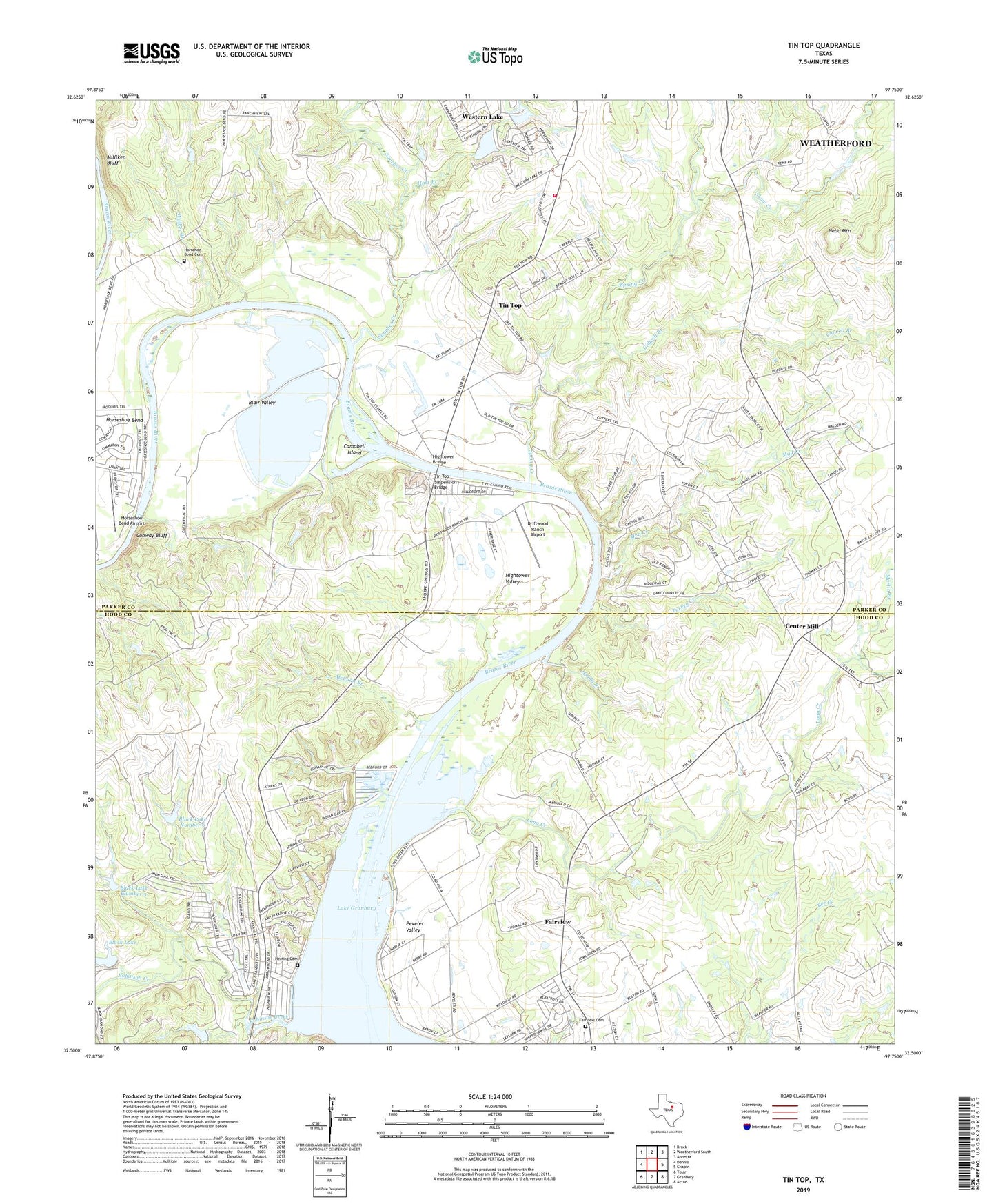
2019 topographic map quadrangle Tin Top in the state of Texas. Scale: 1:24000. Based on the newly updated USGS 7.5' US Topo map series, this map is in the following counties: Parker, Hood. The map contains contour data, water features, and other items you are used to seeing on USGS maps, but also has updated roads and other features. This is the next generation of topographic maps. Printed on high-quality waterproof paper with UV fade-resistant inks.
Quads adjacent to this one:
West: Dennis
Northwest: Brock
North: Weatherford South
Northeast: Annetta
East: Chapin
Southeast: Acton
South: Granbury
Southwest: Tolar
Contains the following named places: Black Lake, Black Lake Dam, Black Lake Number 5, Black Lake Number 5 Dam, Black Lake Number 6, Black Lake Number 6 Dam, Blair Valley, Blair Valley Cemetery, Campbell Island, Center Mill, Cidwell Branch, Conway Bluff, Driftwood Ranch Airport, Fairview, Fairview Baptist Church, Fairview Cemetery, Fairview Church, Hart Branch, Haydon Creek, Herring Cemetery, Hightower Bridge, Hightower Valley, Horseshoe Bend Airport, Horseshoe Lake, Horseshoe Lake Dam, Irby Cemetery, Jacobs Branch, Long Creek, Martin Branch, McCuan Branch, Mill Creek, Milliken Bluff, Mud Creek, Nebo Mountain, New Prospect Church, Parker County Emergency Services District 6 Station 244 Tintop, Peveler Valley, Robinson Creek, Sanchez Creek, Shaw Creek, Spring Creek, Stark Field Airport, Temple Hall Church, Tin Top, Tin Top Suspension Bridge, Turkey Creek, Walker Bend Cemetery, Walker Branch, Western Lake, Western Lake Census Designated Place, Western Lake Dam