MyTopo
Weatherford South Texas US Topo Map
Couldn't load pickup availability
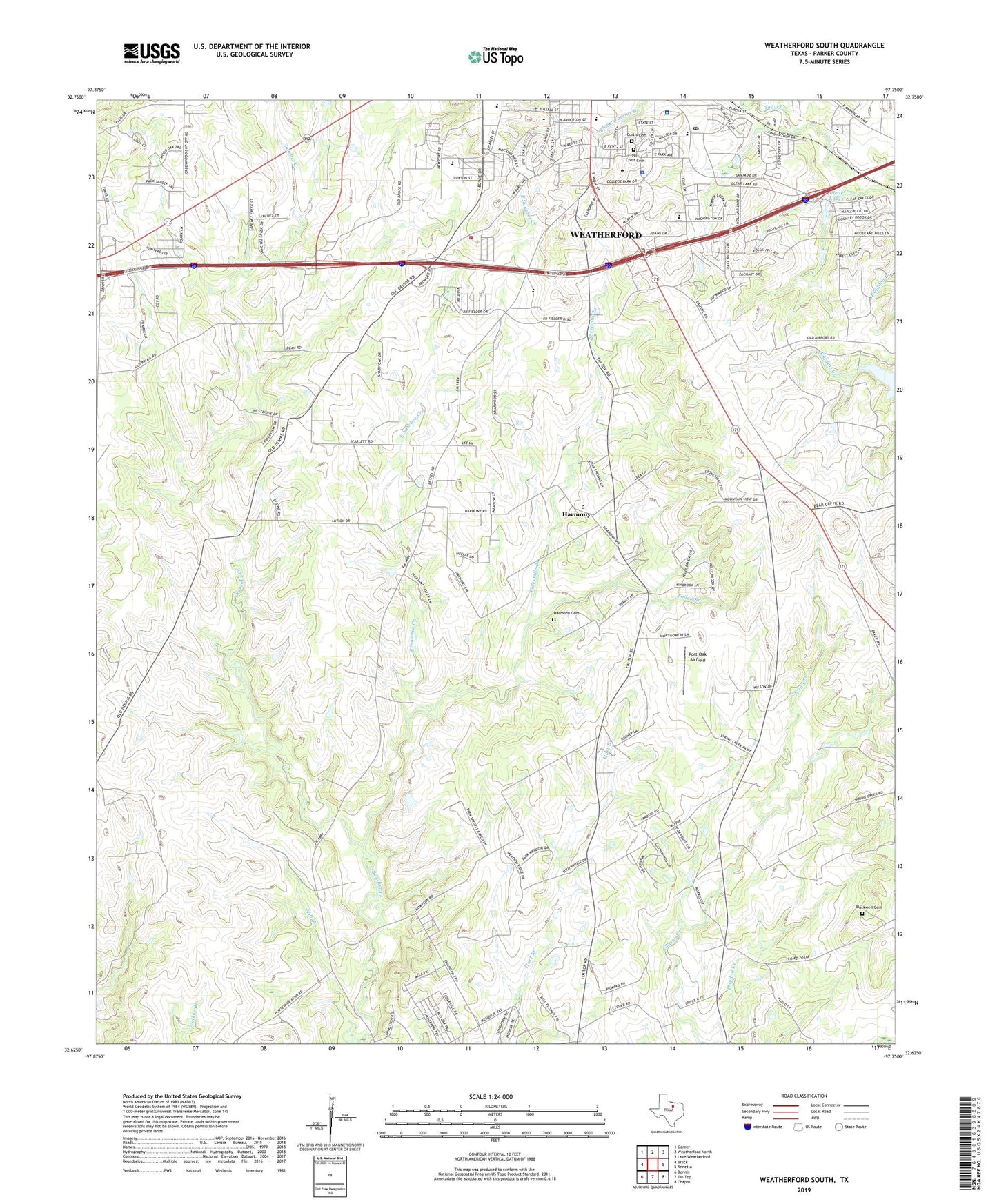
2022 topographic map quadrangle Weatherford South in the state of Texas. Scale: 1:24000. Based on the newly updated USGS 7.5' US Topo map series, this map is in the following counties: Parker. The map contains contour data, water features, and other items you are used to seeing on USGS maps, but also has updated roads and other features. This is the next generation of topographic maps. Printed on high-quality waterproof paper with UV fade-resistant inks.
Quads adjacent to this one:
West: Brock
Northwest: Garner
North: Weatherford North
Northeast: Lake Weatherford
East: Annetta
Southeast: Chapin
South: Tin Top
Southwest: Dennis
This map covers the same area as the classic USGS quad with code o32097f7.
Contains the following named places: Amigo for Christ Airport, Austin Elementary School, Bethel, Bethel Methodist Church Cemetery, Blackwell Cemetery, Buckmaster Heliport, Campbell Health System, Campbell Memorial Hospital Heliport, Church of Christ - Windmill, Clear Lakes, Curtis Cemetery, Curtis Elementary School, East Sanchez Creek, Folley Branch, Hall Junior High School, Harmony, Harmony Baptist Church, Harmony Cemetery, Hill Crest Cemetery, Holland Lake Park, Houston Elementary School, Johnson Family Cemetery, Kangaroo Stadium, Life Care EMS Station 1, Live Oak Country Club, Parker County Constable's Office Precinct 3, Parker County Courthouse, Parker County Fire Marshal's Office, Post Oak Airfield, Saint Stephens Catholic Church, Sam Little International Airport, Santa Fe Drive Baptist Church, Soldier Springs Park, Spring Creek Baptist Church, Spring Creek Church, The Church of Jesus Christ of Latter Day Saints, The Double Log Cabin, Threemile Branch, Weatherford College Police Department, Weatherford High School, Weatherford Post Office, Weatherford Regional Medical Center, ZIP Code: 76087