MyTopo
Brock Texas US Topo Map
Couldn't load pickup availability
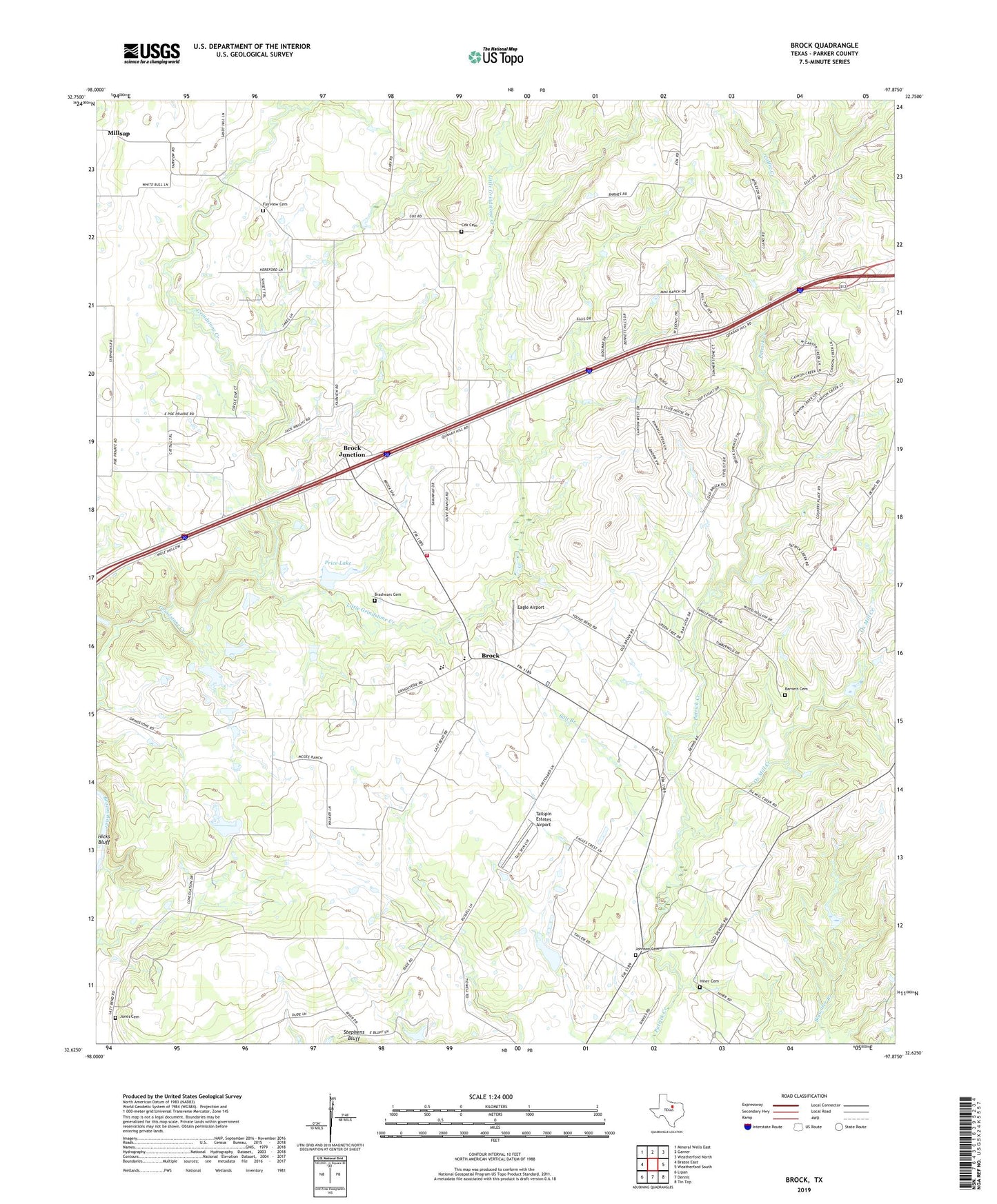
2022 topographic map quadrangle Brock in the state of Texas. Scale: 1:24000. Based on the newly updated USGS 7.5' US Topo map series, this map is in the following counties: Parker. The map contains contour data, water features, and other items you are used to seeing on USGS maps, but also has updated roads and other features. This is the next generation of topographic maps. Printed on high-quality waterproof paper with UV fade-resistant inks.
Quads adjacent to this one:
West: Brazos East
Northwest: Mineral Wells East
North: Garner
Northeast: Weatherford North
East: Weatherford South
Southeast: Tin Top
South: Dennis
Southwest: Lipan
This map covers the same area as the classic USGS quad with code o32097f8.
Contains the following named places: Barnett Cemetery, Brashears Cemetery, Brock, Brock - Dennis Volunteer Fire Department Station 1, Brock - Dennis Volunteer Fire Department Station 3, Brock Baptist Church, Brock Junction, Brock Methodist Church, Brock West, Coffee Creek, Cox Cemetery, Dennis Church, Eagle Airport, Edwards Cemetery, Fairview Cemetery, Gilbert Family Cemetery, Harrison Cemetery, HH Battern Cemetery, Hicks Bluff, Hiner Cemetery, Johnson Cemetery, Jones Cemetery, Little Grindstone Creek, Olive Branch, Ox Mill Creek, Price Lake, Price Lake Dam, Salt Branch, Samuel B Smith Burial Plot, Stephens Bluff, Tailspin Estates Airport, Taylors Big Lake, Taylors Big Lake Dam, Town of Brock West, Weatherford Division, Welch Cemetery, ZIP Code: 76066