MyTopo
Tivoli Texas US Topo Map
Couldn't load pickup availability
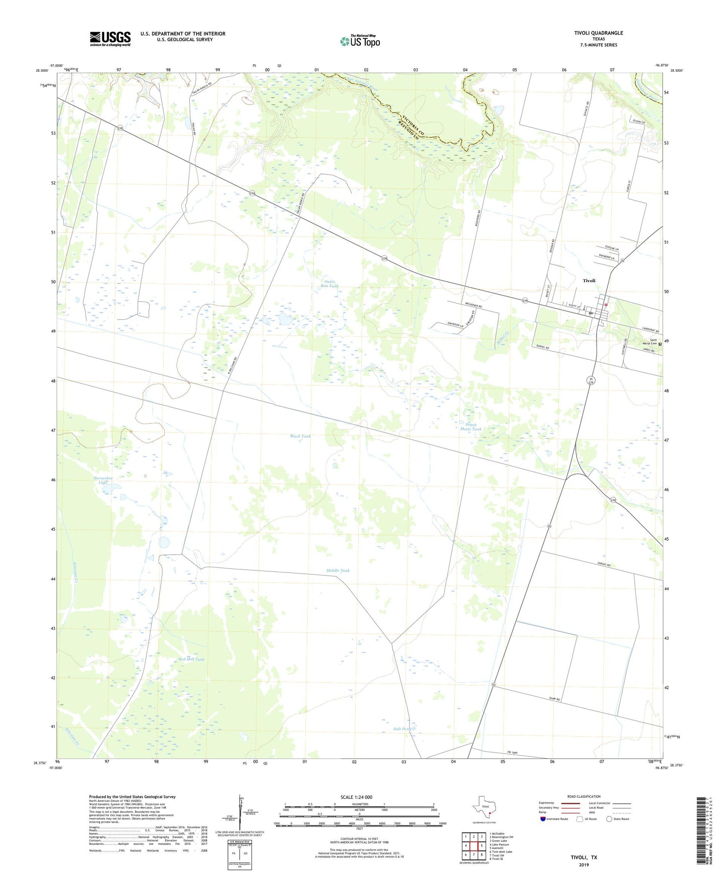
2019 topographic map quadrangle Tivoli in the state of Texas. Scale: 1:24000. Based on the newly updated USGS 7.5' US Topo map series, this map is in the following counties: Refugio, Victoria, Calhoun. The map contains contour data, water features, and other items you are used to seeing on USGS maps, but also has updated roads and other features. This is the next generation of topographic maps. Printed on high-quality waterproof paper with UV fade-resistant inks.
Quads adjacent to this one:
West: Lake Pasture
Northwest: McFaddin
North: Bloomington SW
Northeast: Green Lake
East: Austwell
Southeast: Tivoli SE
South: Tivoli SW
Southwest: Twin Mott Lake
Contains the following named places: Anaqua Tank, Austwell - Tivoli High School, Black Tank, Dietrich Well, Horseshoe Lake, Langraft Well, Little Well, Maudlowe, Middle Tank, Outer Rim Tank, Outer Rim Well, Peach Motte Tank, Red Mill Tank, Refugio County Sheriff's Office, Saint Marys Cemetery, Salt Pond, Tivoli, Tivoli Census Designated Place, Tivoli Elementary School, Tivoli Post Office, Tivoli Volunteer Fire Department, ZIP Code: 77990