
MyTopo
Turnersville Texas US Topo Map
Couldn't load pickup availability
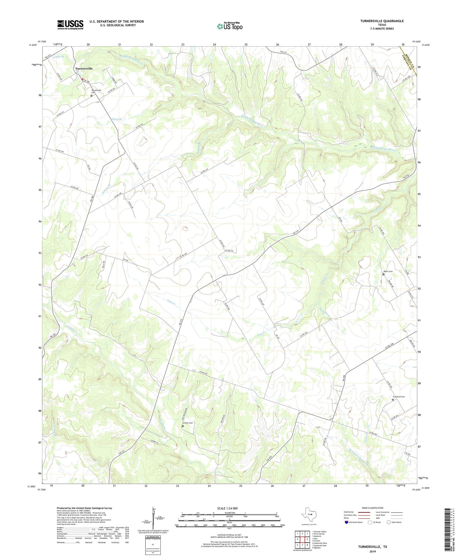
2019 topographic map quadrangle Turnersville in the state of Texas. Scale: 1:24000. Based on the newly updated USGS 7.5' US Topo map series, this map is in the following counties: Coryell, Bosque. The map contains contour data, water features, and other items you are used to seeing on USGS maps, but also has updated roads and other features. This is the next generation of topographic maps. Printed on high-quality waterproof paper with UV fade-resistant inks.
Quads adjacent to this one:
West: Ater
Northwest: German Valley
North: Hurst Spring
Northeast: Mosheim
East: Coryell
Southeast: Oglesby
South: Gatesville East
Southwest: Gatesville West
Contains the following named places: Coffee Cemetery, Coryell Valley Church, Crawford Cemetery, Goldys Branch, Liberty Church, Mccutchen Branch Clear Creek, Miller Cemetery, Pickens Branch, Pickens Pool, Thorp Branch, Turnersville, Turnersville Cemetery, Turnersville Volunteer Fire Department, White-Hall


