MyTopo
Valentine West Texas US Topo Map
Couldn't load pickup availability
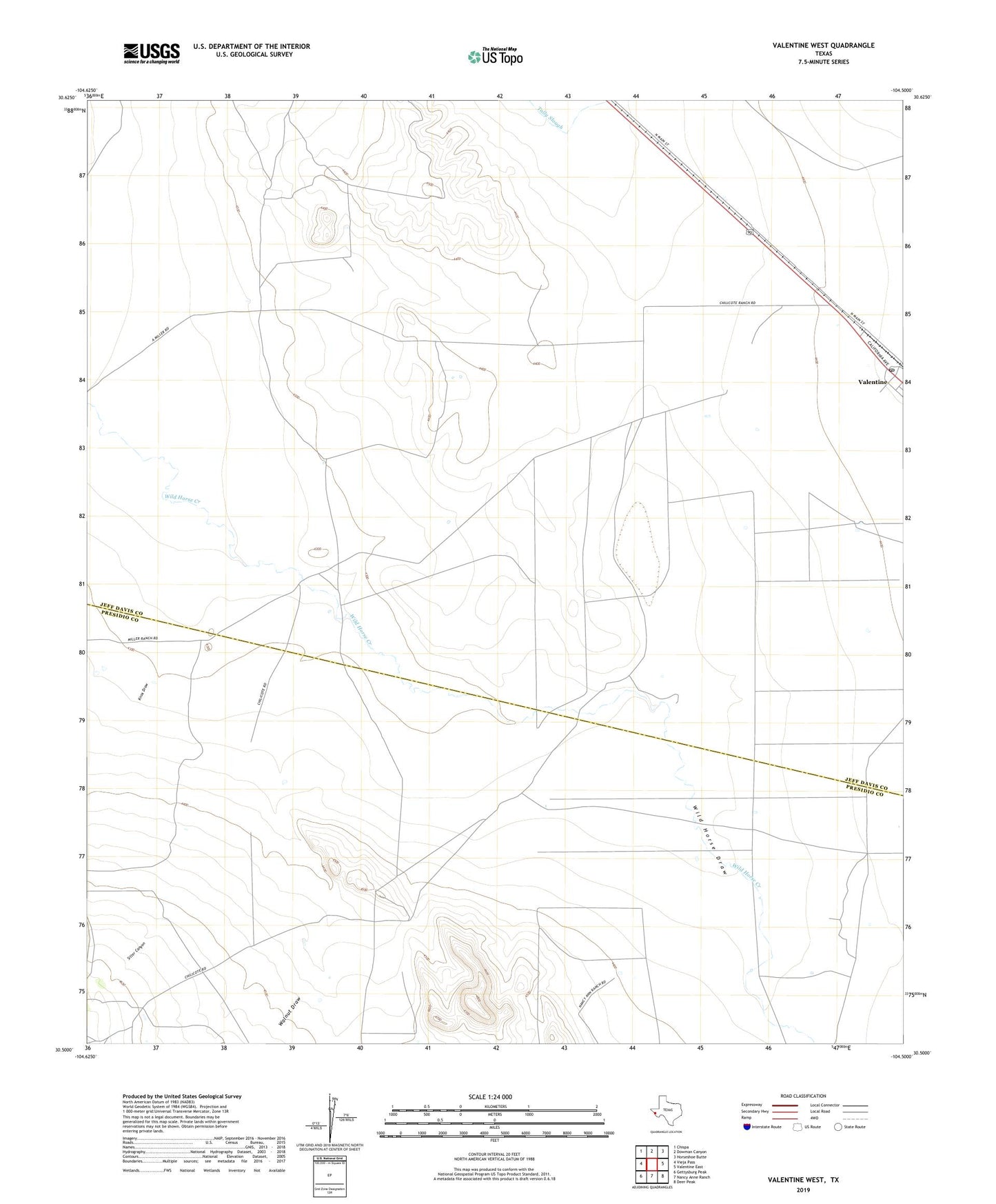
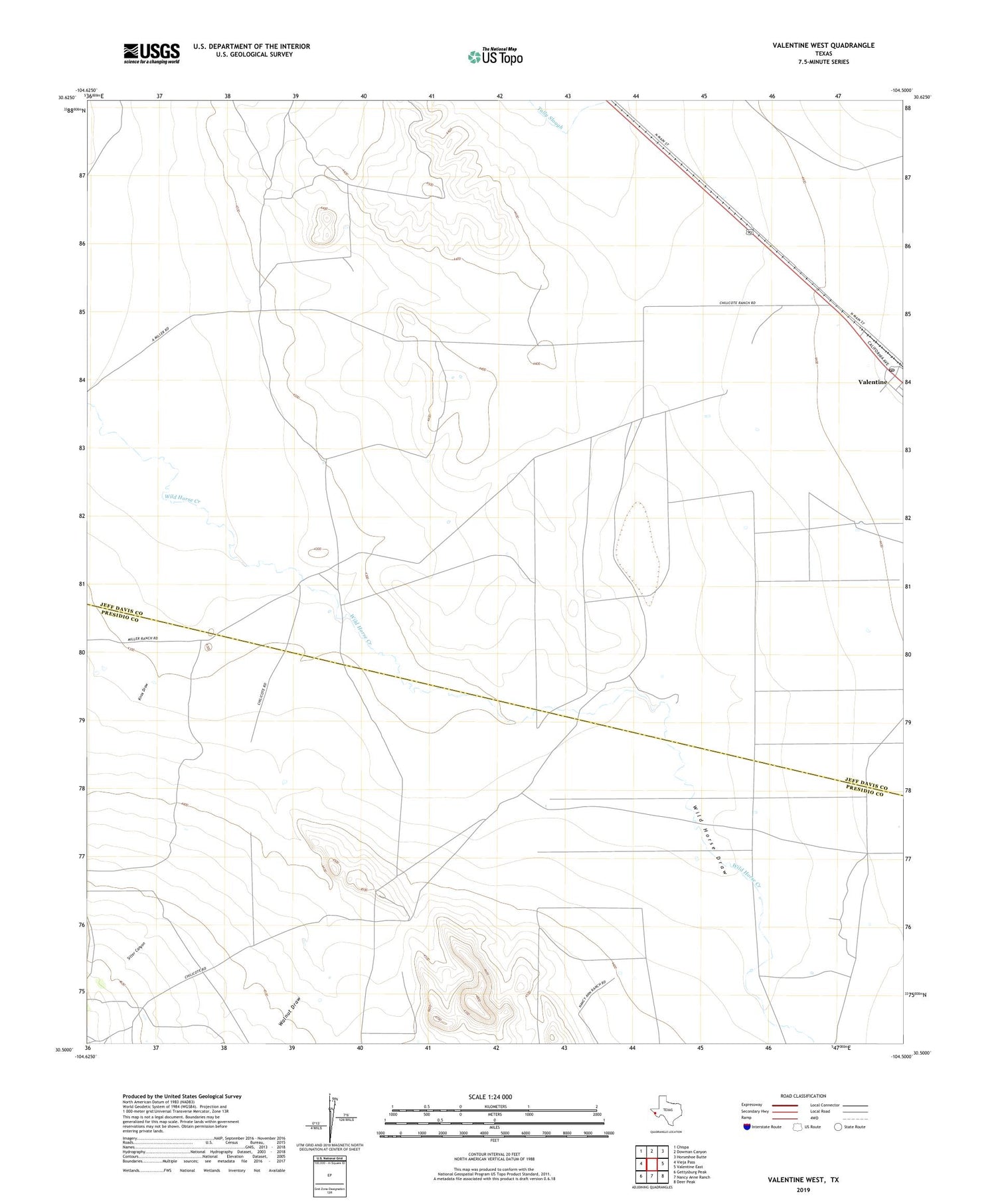
2019 topographic map quadrangle Valentine West in the state of Texas. Scale: 1:24000. Based on the newly updated USGS 7.5' US Topo map series, this map is in the following counties: Jeff Davis, Presidio. The map contains contour data, water features, and other items you are used to seeing on USGS maps, but also has updated roads and other features. This is the next generation of topographic maps. Printed on high-quality waterproof paper with UV fade-resistant inks.
Quads adjacent to this one:
West: Vieja Pass
Northwest: Chispa
North: Dowman Canyon
Northeast: Horseshoe Butte
East: Valentine East
Southeast: Deer Peak
South: Nancy Anne Ranch
Southwest: Gettysburg Peak
Contains the following named places: Conring Ranch, Knox Draw, Roosevelt Ranch, Sitter Canyon, Valentine Post Office, Walnut Draw