MyTopo
Veach Texas US Topo Map
Couldn't load pickup availability
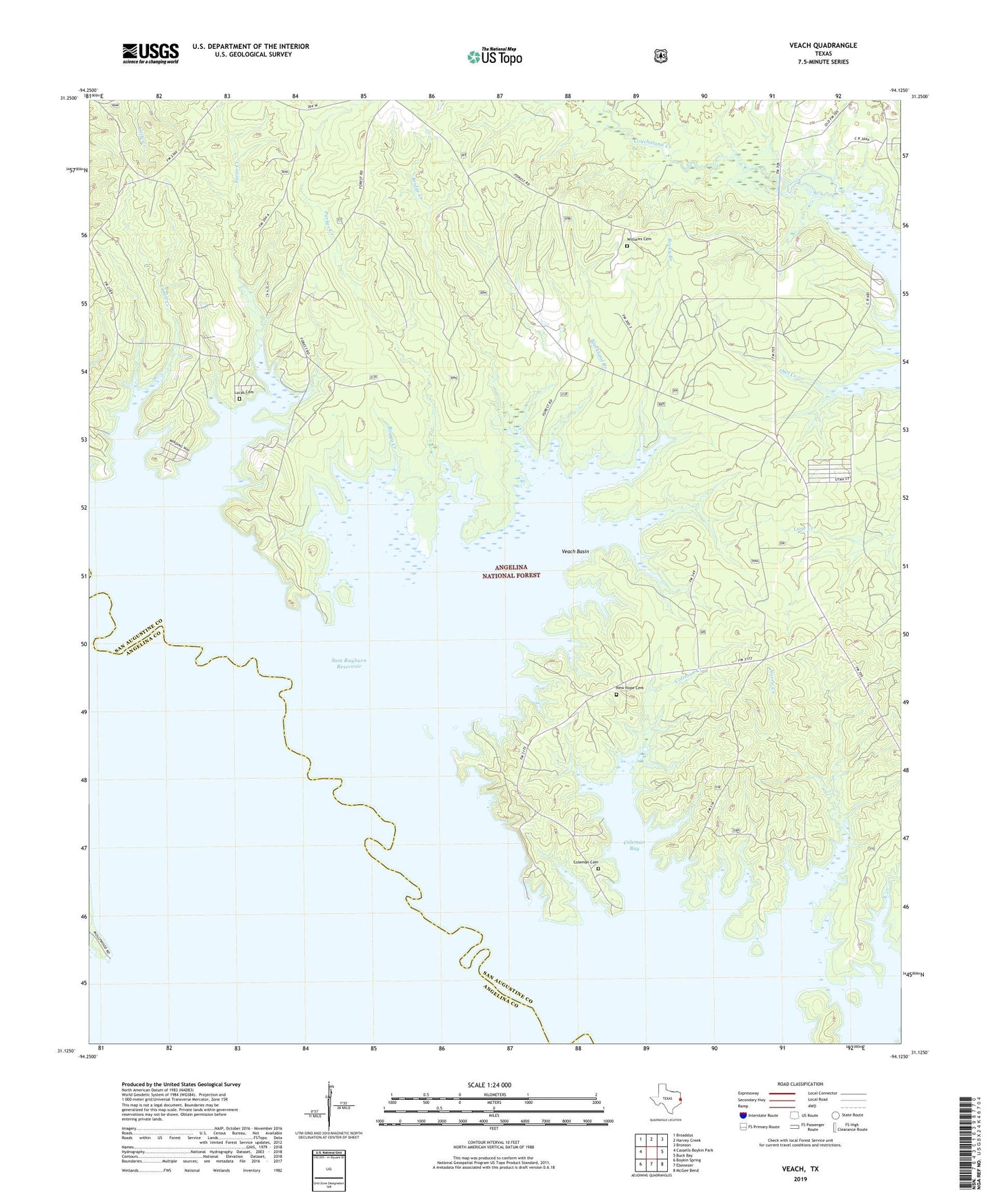
2019 topographic map quadrangle Veach in the state of Texas. Scale: 1:24000. Based on the newly updated USGS 7.5' US Topo map series, this map is in the following counties: San Augustine, Angelina. The map contains contour data, water features, and other items you are used to seeing on USGS maps, but also has updated roads and other features. This is the next generation of topographic maps. Printed on high-quality waterproof paper with UV fade-resistant inks.
Quads adjacent to this one:
West: Cassells-Boykin Park
Northwest: Broaddus
North: Harvey Creek
Northeast: Bronson
East: Buck Bay
Southeast: McGee Bend
South: Ebenezer
Southwest: Boykin Spring
Contains the following named places: Blackland Branch, Boggy Creek, Bridge Creek, Cadell Creek, Campbell Branch, Caney Creek, Coleman Bay, Coleman Cemetery, Coleman Creek, Concord Church, Five Fingers, High Point Lookout, High Point Lookout Tower, Hornsby Creek, Little Caney Creek, Lucas Cemetery, Lucas Creek, McGilberry Cemetery, McGilberry Lake, Mott Cemetery, New Hope Cemetery, Oak Grove Church, Parker Creek, Rocky Branch, Rocky Creek, Sinclair Cemetery, Veach, Veach Basin, Williams Cemetery, Yellow Ridge Church, ZIP Code: 75929