MyTopo
Waring Texas US Topo Map
Couldn't load pickup availability
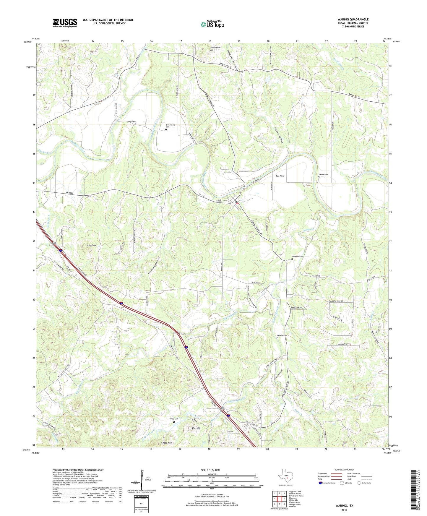
2019 topographic map quadrangle Waring in the state of Texas. Scale: 1:24000. Based on the newly updated USGS 7.5' US Topo map series, this map is in the following counties: Kendall. The map contains contour data, water features, and other items you are used to seeing on USGS maps, but also has updated roads and other features. This is the next generation of topographic maps. Printed on high-quality waterproof paper with UV fade-resistant inks.
Quads adjacent to this one:
West: Comfort
Northwest: Cypress Creek
North: Rafter Hollow
Northeast: Whitworth Ranch
East: Sisterdale
Southeast: Boerne
South: Ranger Creek
Southwest: Turkey Knob
Contains the following named places: Allen Creek, Ammann Cemetery, Beseler Cemetery, Big Joshua Creek, Block Creek, Brownsboro Cemetery, Camp Capers, Camp Capers Church, Coffee Hollow, First Coffee Hollow, Flat Rock Creek, Holliday Creek, Insall Cemetery, James Kiehl River Bend Park, Joshua Creek, Jungfrau, Little Joshua Creek, Nelson City, Possum Creek, Ring Mountain, Rust Field, Schleicher Mountain, Second Coffee Hollow, Waring, Waring Baptist Church, Waring Community Center, Waring Post Office, Waring Volunteer Fire Department, Welfare, White Cemetery, Zinke Creek, Zoeller Cemetery