MyTopo
Sisterdale Texas US Topo Map
Couldn't load pickup availability
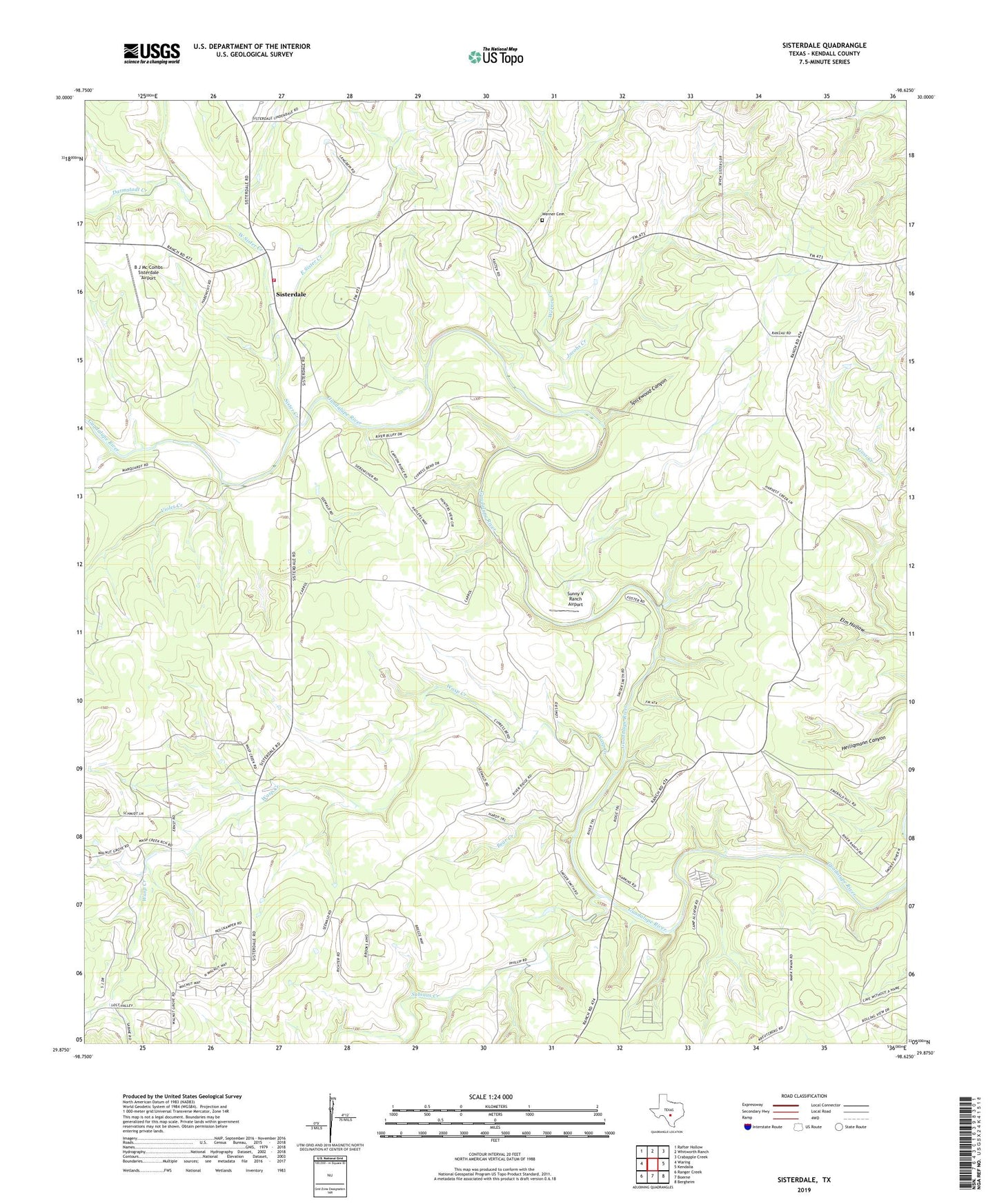
2022 topographic map quadrangle Sisterdale in the state of Texas. Scale: 1:24000. Based on the newly updated USGS 7.5' US Topo map series, this map is in the following counties: Kendall. The map contains contour data, water features, and other items you are used to seeing on USGS maps, but also has updated roads and other features. This is the next generation of topographic maps. Printed on high-quality waterproof paper with UV fade-resistant inks.
Quads adjacent to this one:
West: Waring
Northwest: Rafter Hollow
North: Whitworth Ranch
Northeast: Crabapple Creek
East: Kendalia
Southeast: Bergheim
South: Boerne
Southwest: Ranger Creek
This map covers the same area as the classic USGS quad with code o29098h6.
Contains the following named places: Ammans Crossing, B J Mc Combs Sisterdale Airport, Baptist Church, Bear Creek, Camp Alzafar, Darmstadt Creek, East Sister Creek, Elm Hollow, Guadalupe River Ranch, Jacobs Creek, Kendall County, Sabinas Creek, Sister Creek, Sisterdale, Sisterdale Community Center, Sisterdale Post Office, Sisterdale Volunteer Fire Department, Spicewood Canyon, Sunny V Ranch Airport, Violet Creek, Wasp Creek, Werner Cemetery, Werner Creek, West Sister Creek